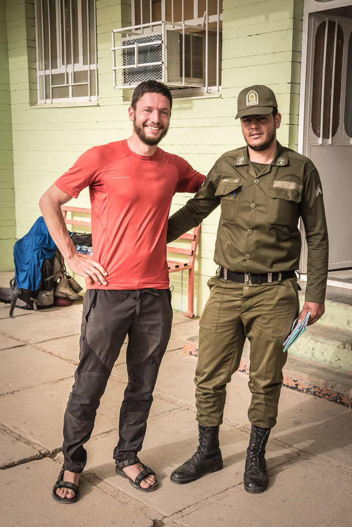
After exploring the desert and the mountains around Kerman I thought about continuing further East to Bam, Zahedan to visit the nearby UNESCO listed Shahr-e Sukhte ruins dating back to 3200 BC as well as an active volcano. However, German Foreign Office strongly advises against going to Sistan & Baluchistan regions bordering Afghanistan and Pakistan.
The opinion of the locals about the Eastern region was split. Those who have been there said it’s safe to travel while all others discouraged me from traveling there. I decided to save the region for my next visit to Iran and focused on Western and Northern Iran where numerous places of interest were waiting for me.
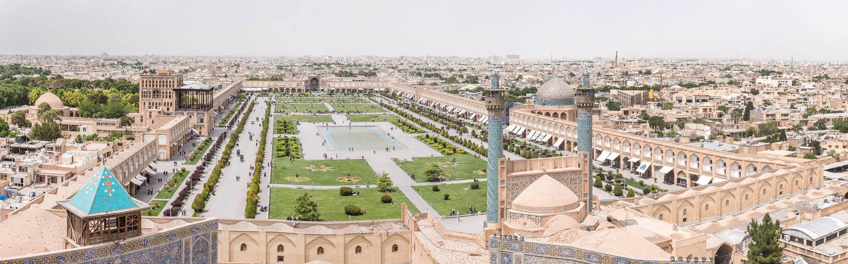
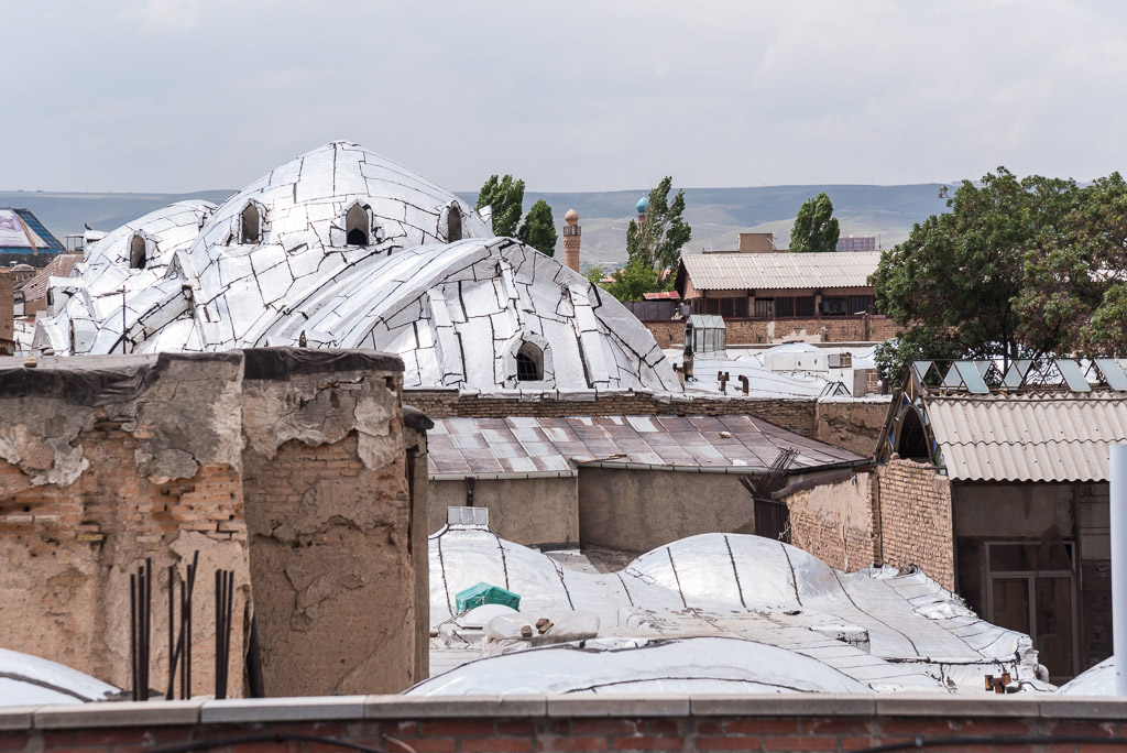
Esfahan
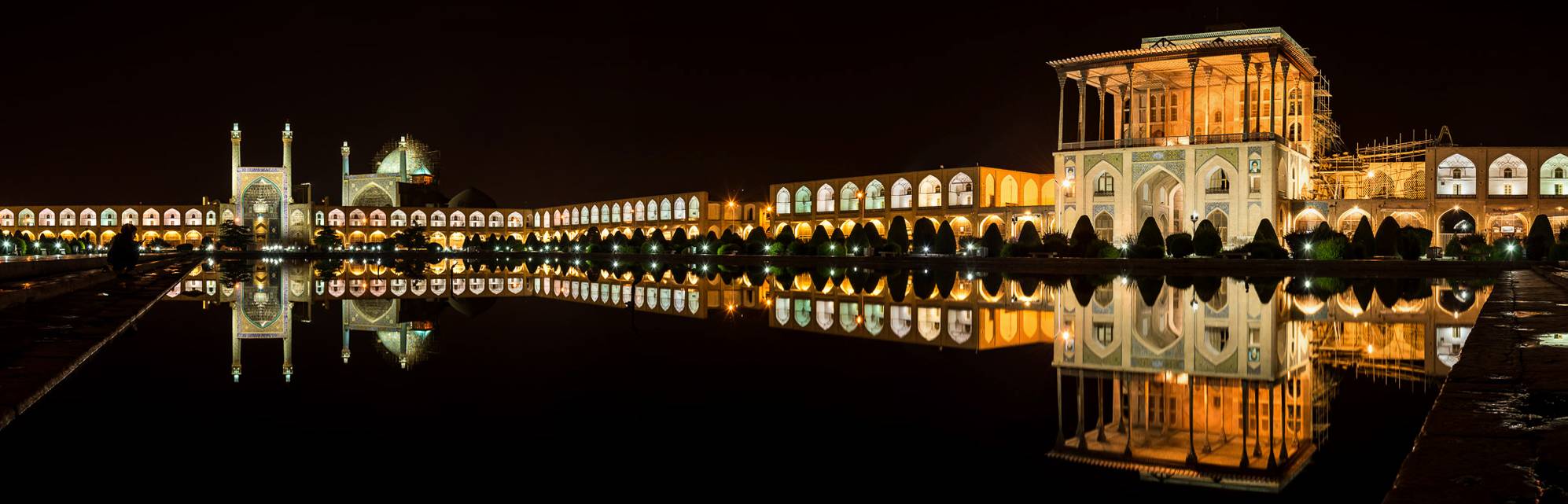
Naghsh-e Jahan square at a windless night with Shah mosque left and Ali Qapu right
Lotfallah mosque in the center and Shah mosque right
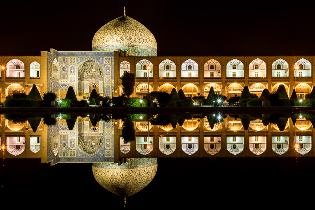
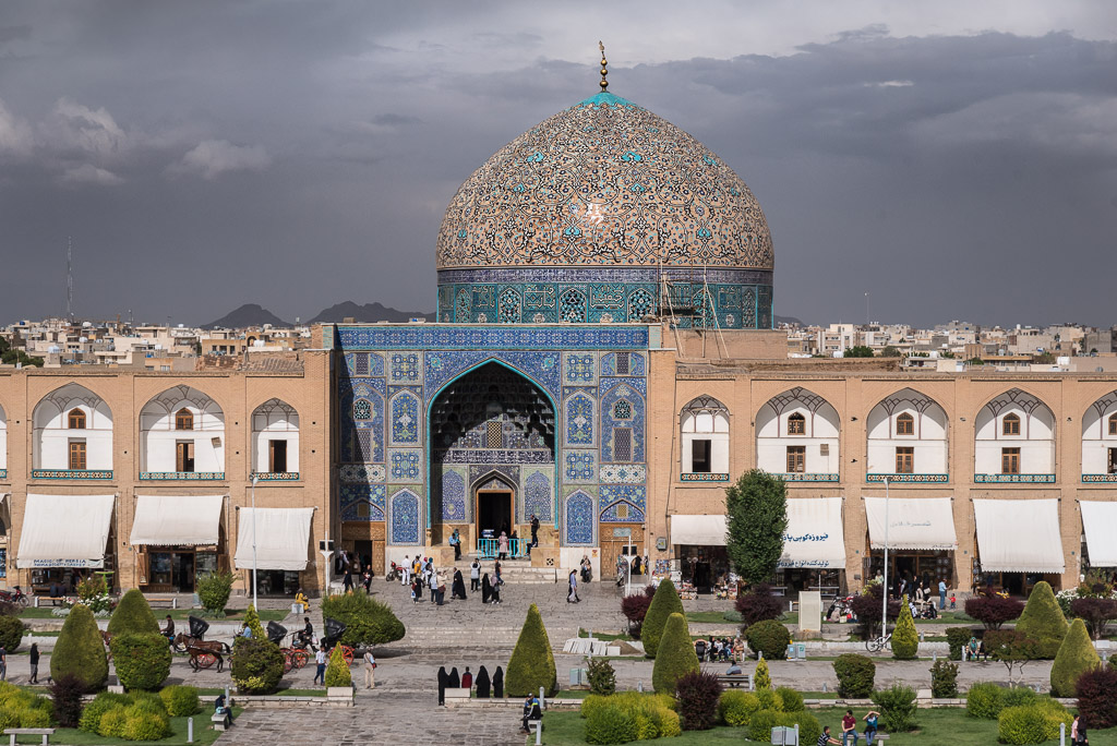
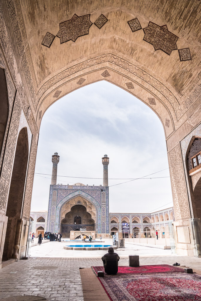
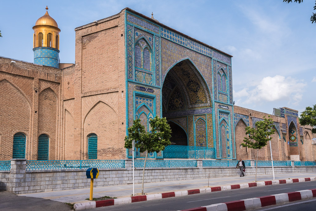
UNESCO world heritage listed Naghsh-e Jahan square with Shah mosque in the foreground
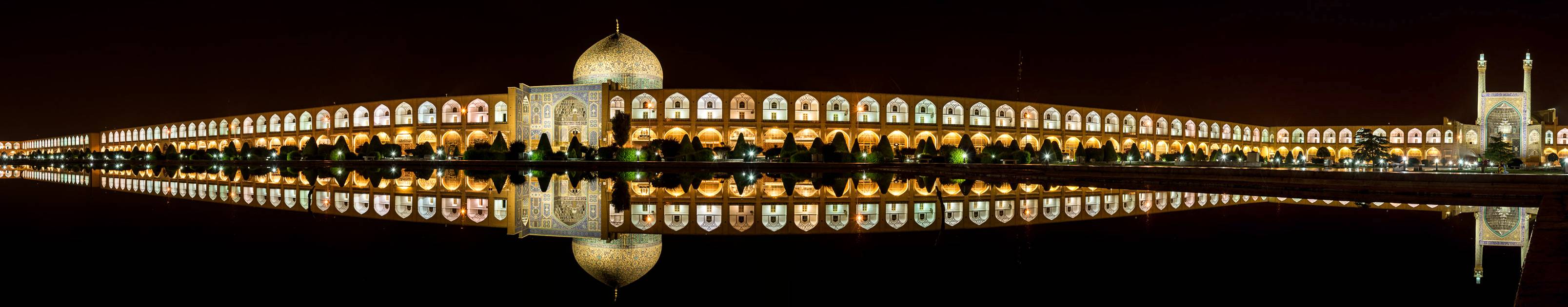
Esfahan is definitely the touristic capital of Iran. Loads of groups of elderly European tourists flocked to the famous mosques, squares and palaces that give Esfahan its beautiful and impressive appearance. OK, I’m exaggerating a bit, its not (yet) the Venice of the Middle-East 😉
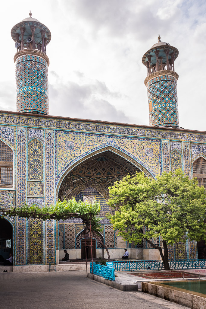
Sheikh Lotf Allah mosque

Naghsh-e Jahan square with Shah mosque minutes before „daily“ thunderstorm
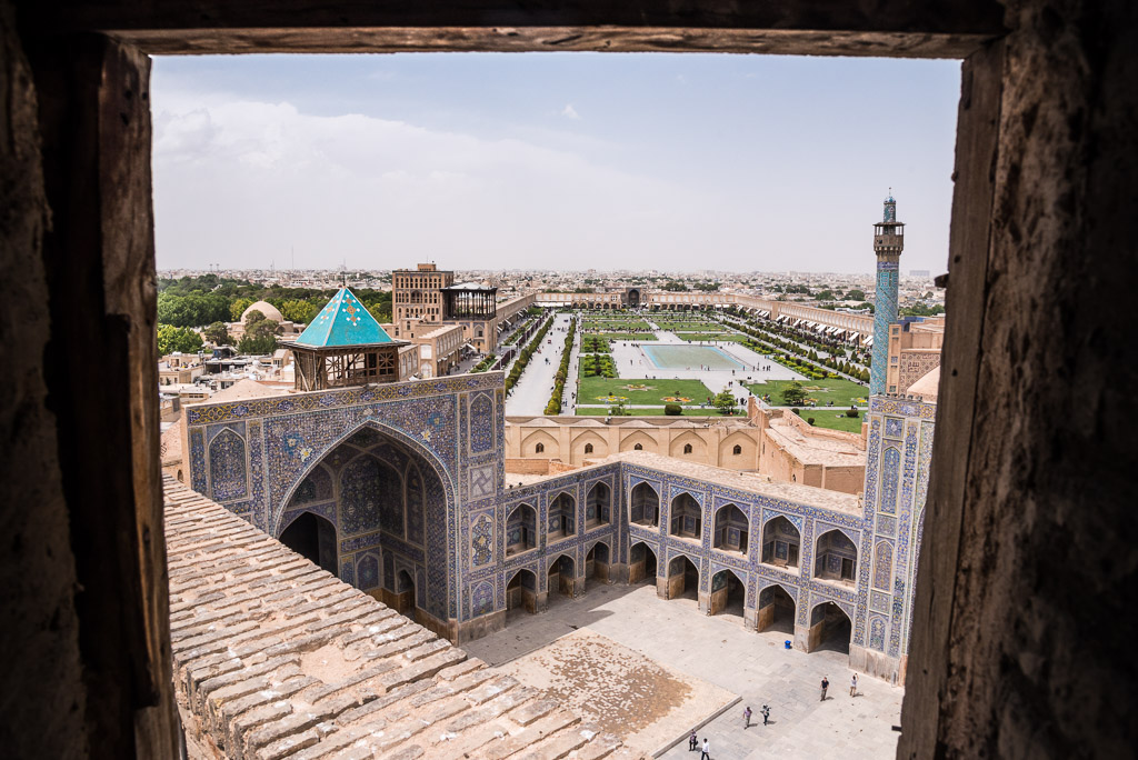
Marjan made my day by taking me up the minaret of Shah mosque that overlooks Naghsh-e Jahan square. Marjan, who works as a German speaking tour guide, knew the caretaker of Shah mosque who opened the door to the minaret that is otherwise only open for maintenance.

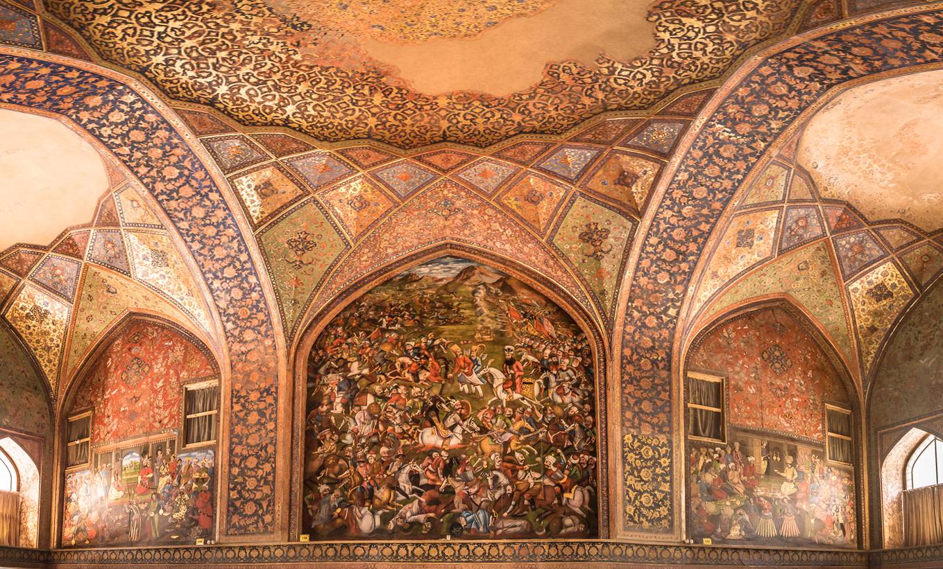
Chehel Sotoun, which literally means „forty columns“, is a beautiful pavilion famous for its paintings.
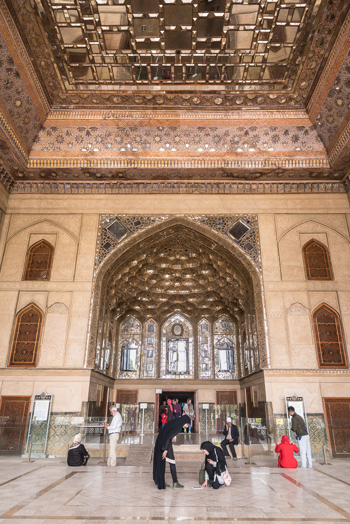
The entrance of Chehel Sotoun
The Armenian Vank cathedral was build by Armenians resettled to Esfahan by the Shah in 17th century
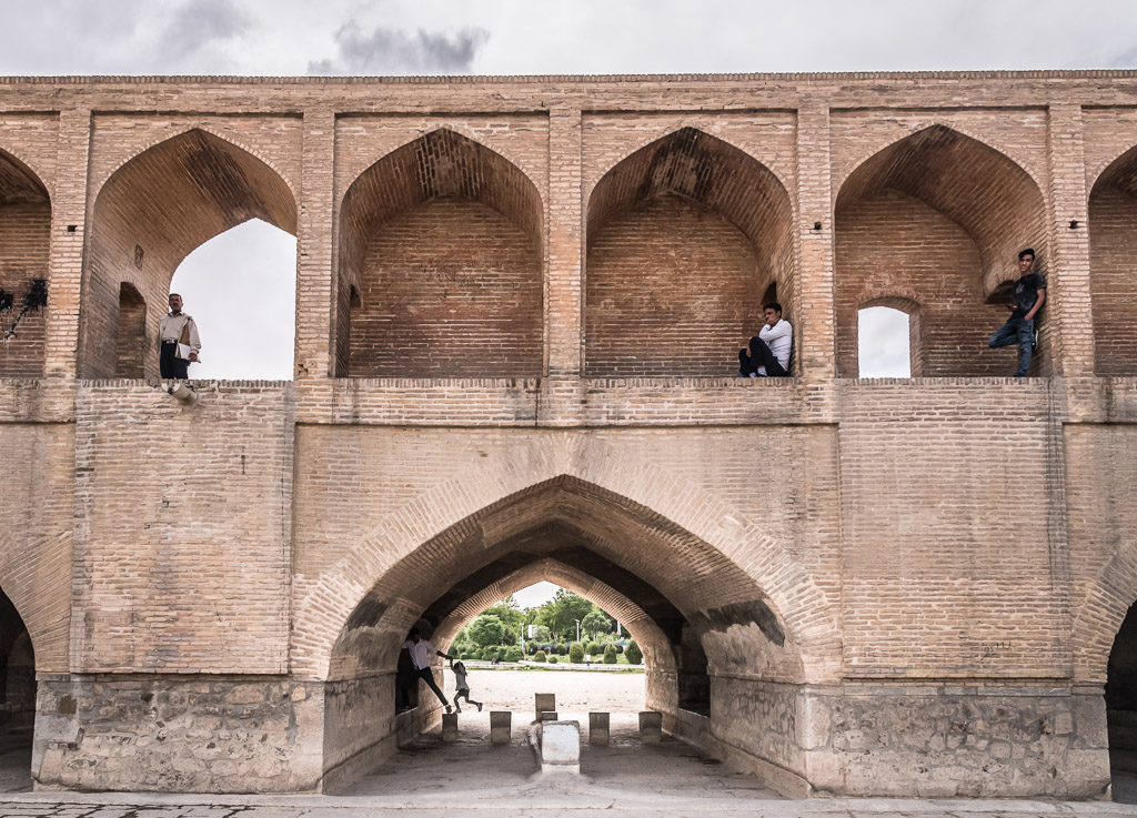
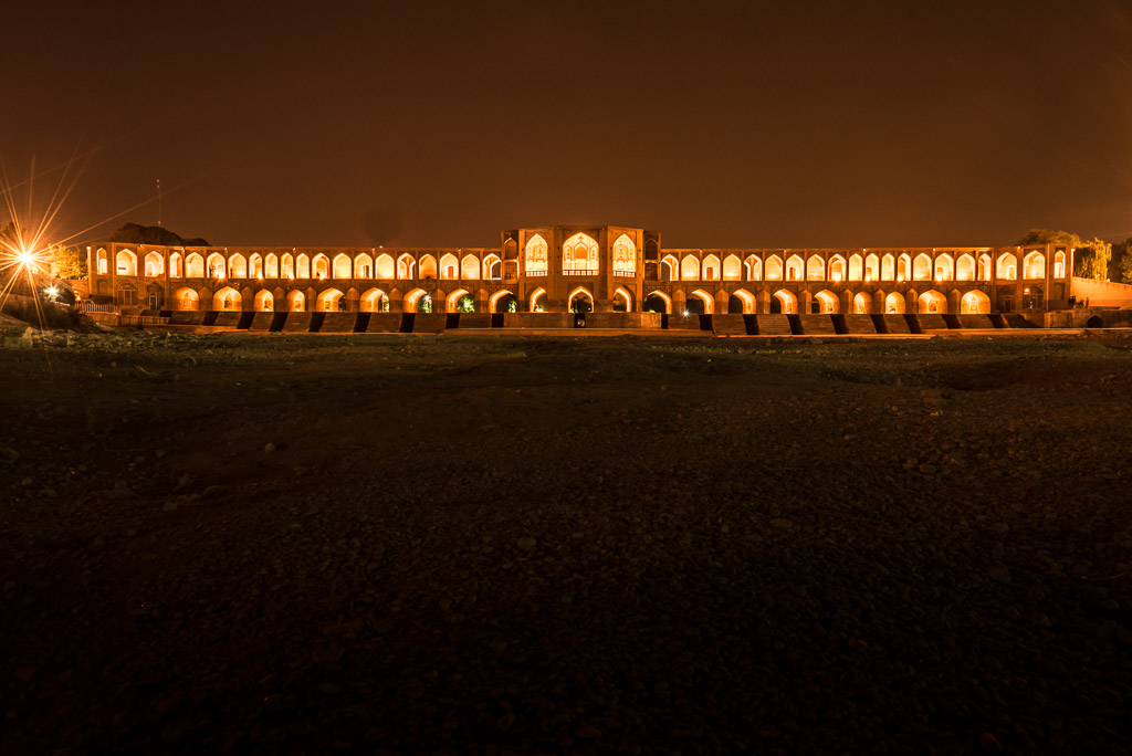
Si-o-seh pol , the bridge of 33 arches
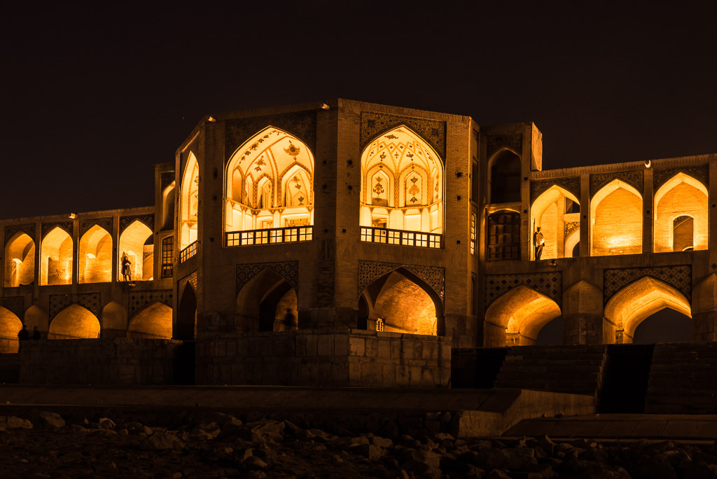
…and at night

Sheikh Lotf Allah mosque and its reflection in the perfectly calm waters of the pond
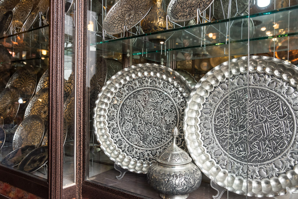
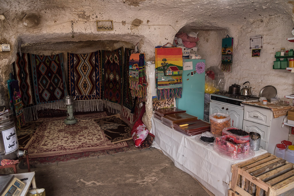
Classical Esfahani handicraft made in the Grand Bazaar
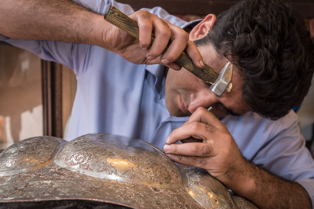
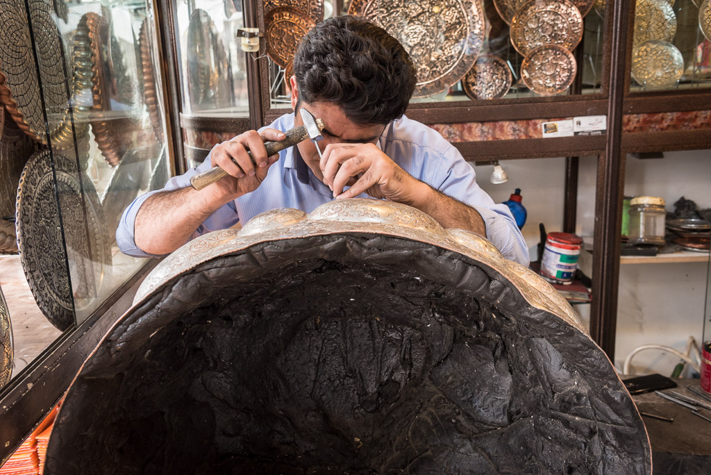
He will work for many month on this huge bowl which is filled with bitumen for stabilisation during manufacturing
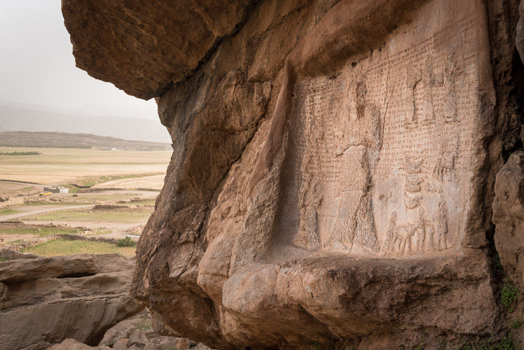
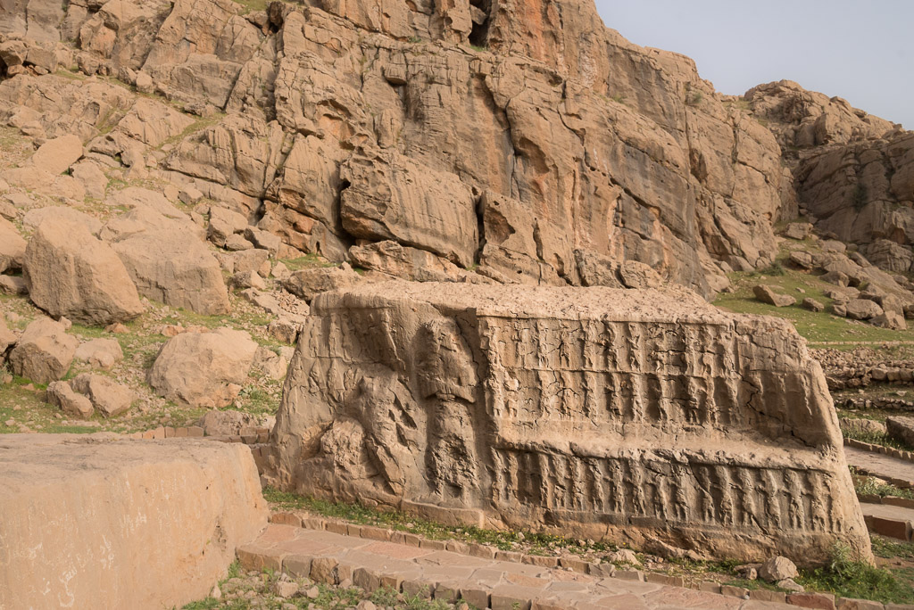
One of the astonishing, three-thousand-year old Elamite stone reliefs of Kul-e Farah near Izeh
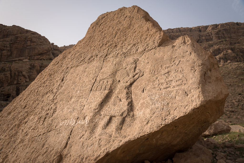
More Elamite stone reliefs in Eshkaft-e Salman
Unsurprisingly, I was the main attraction of the bus station in Izeh 😉
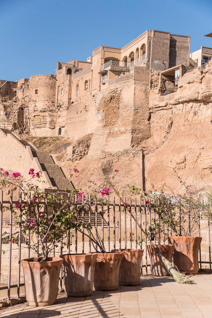
The old town of Shushtar
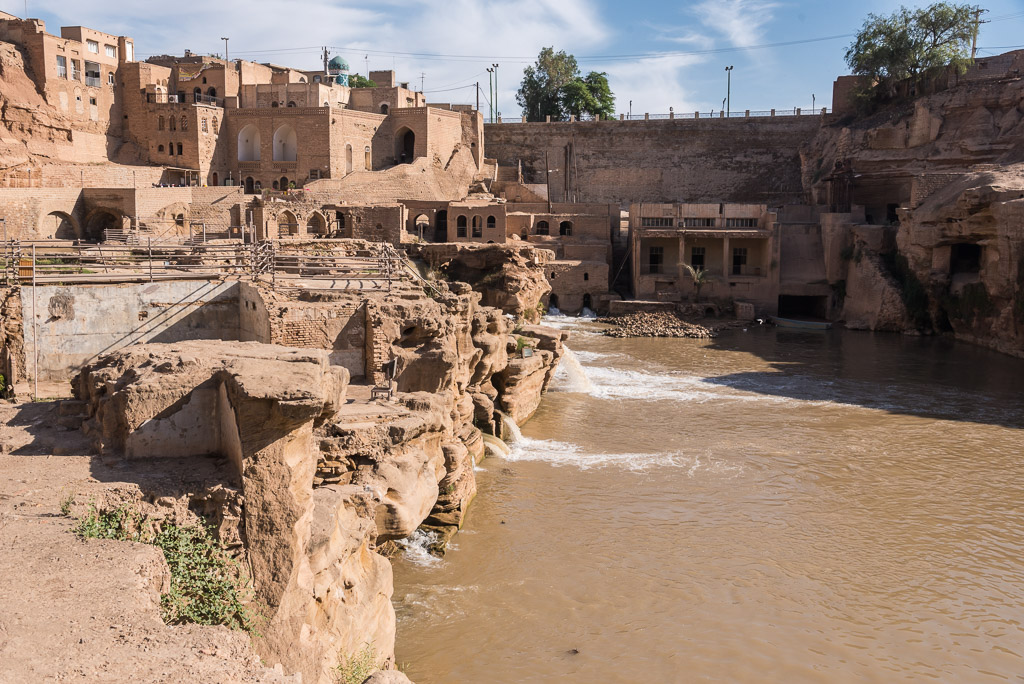
The UNESCO- listed hydraulic system of Shushtar that features dozens of water mills, dams, channels and tunnels
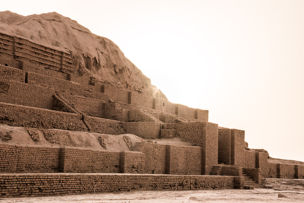
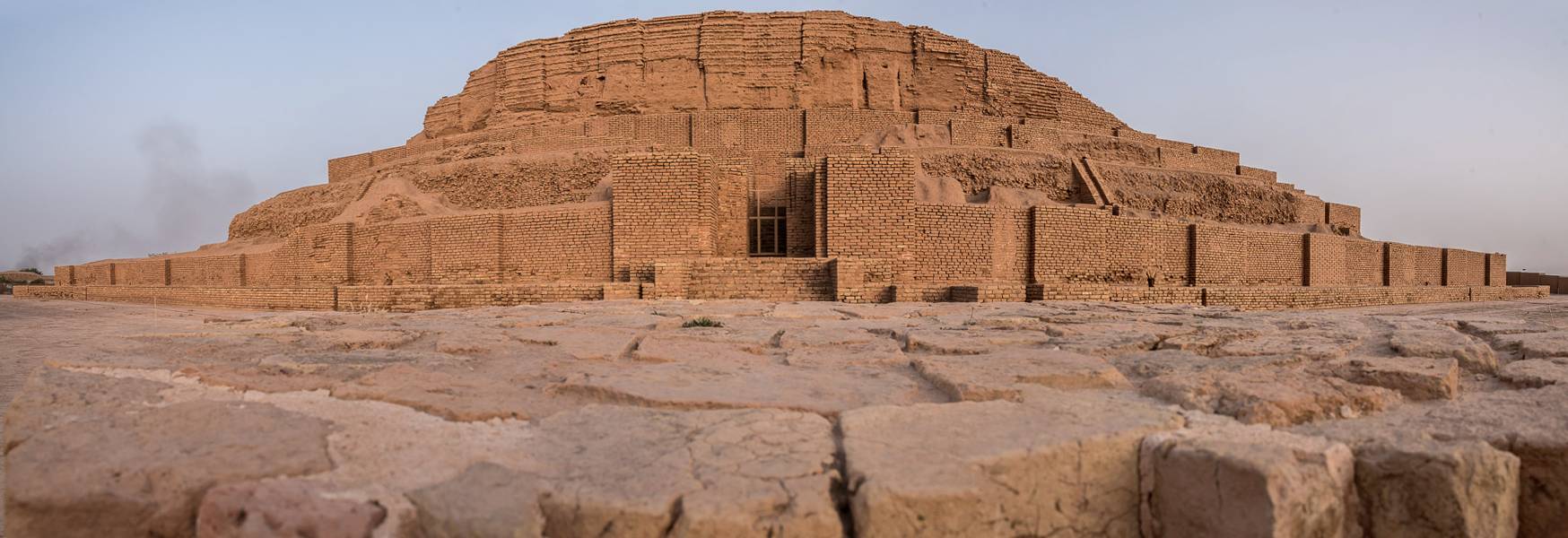
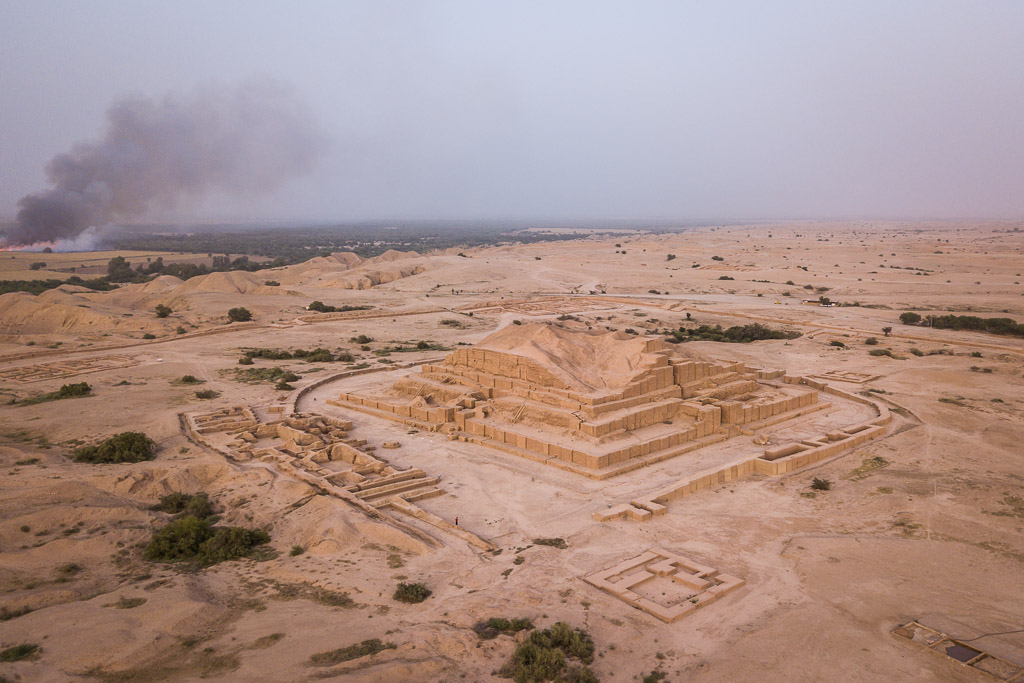
The ruins of the ziggurat of Chogha Zanbil
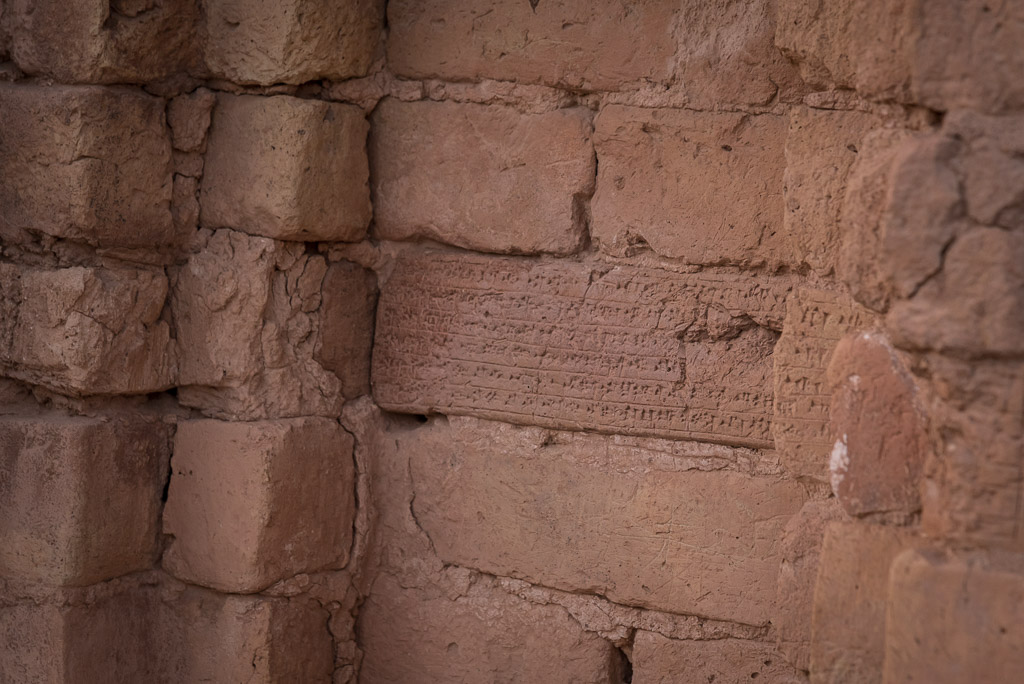
One of the thousands of baked bricks with inscriptions
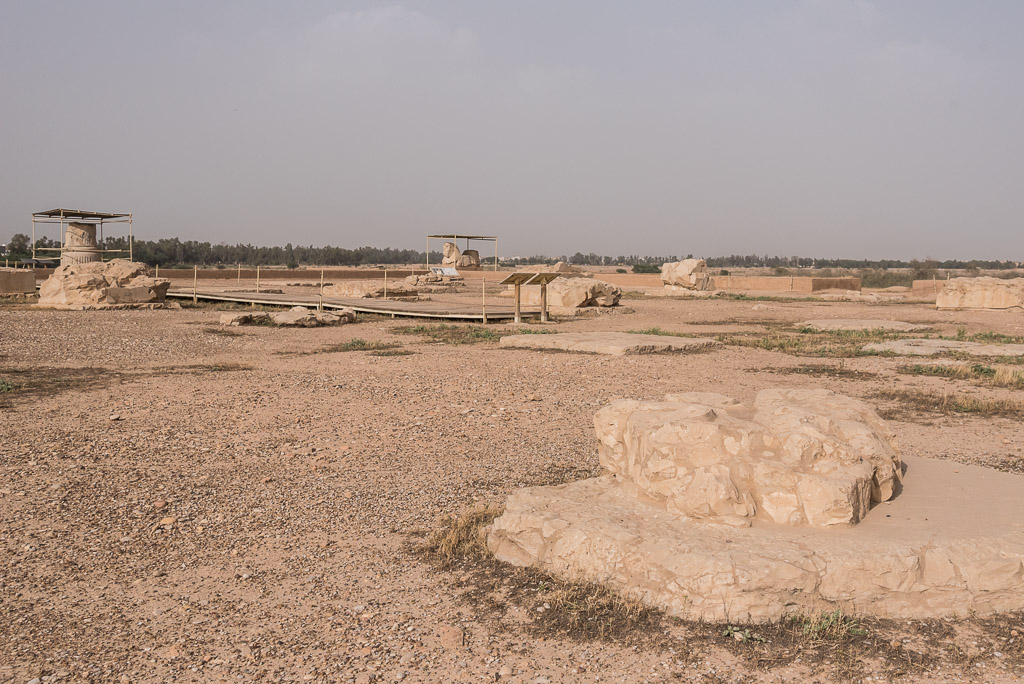
Sush was one of the most important ancient middle-eastern cities that played a significant role in the Elamite, Achaemenide and the successive Persian empire. With first settlements dating back to 9 000 years back, the city definitely deserves the listing as UNESCO world heritage. However, for the non-archeologists it will be most likely disappointing (especially after having seen Persepolis) as not many structures are left.
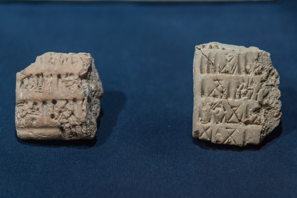
Nevertheless, the Shush museum featured some nice artifacts, like these 5000 years old pieces of clay tablets with proto-Elamite script
After three cold and rainy days in Esfahan (I didn’t expect that in May, but the locals were overjoyed about the „good“ weather) I crossed the Zagros mountains by bus to the sun-burnt province of Khuzestan which used to be a central spot for several ancient civilisations in the Middle-East. The most notable of those was the Elamite empire which ruled the region from the third to the first millennium BC. Today, the importance of the region originates from its rich oil reserves that unfortunately made it a primary target for the Iraqi invasion in 1980. My first stop in Khuzestan was the city of Izeh with several ancient monuments located in the surrounding villages. In contrast to Esfahan, tourism hasn’t arrived to Izeh yet. Not even one shiny hotel or a hip hostel can be found here, the only option is a run-down house where a friendly man offered worn rooms. Due to the helpfulness and patience of locals with my very limited Farsi (and occasional nonsense delivered by Google translator), we quickly overcame the problem that virtually nobody spoke even a word of English. A three-hour bus ride westwards brought me to the city of Shushtar, home to the the UNESCO listed hydraulic system that features numerous water mills Cell Phone Number Trace , dams, tunnels and channels. Not far from Shushtar lays the ziggurat Chogha Zanbil. Built by Elamite king Untash about 1250BC, the originally 53m high stepped pyramid was once crowned with a temple and honoured the great god Inshushinak.
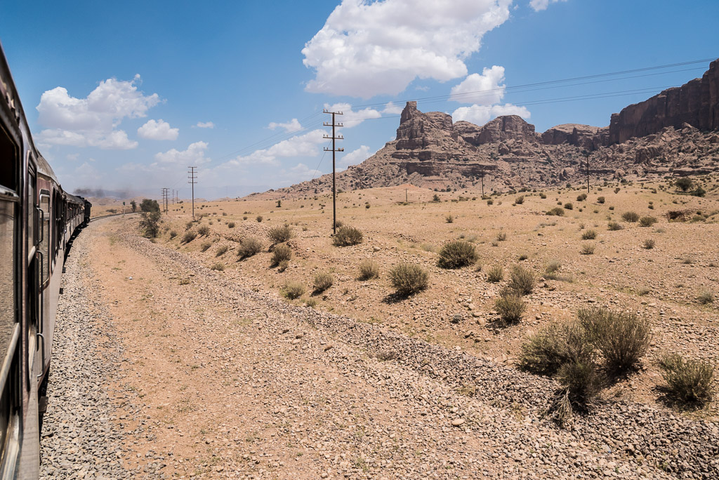
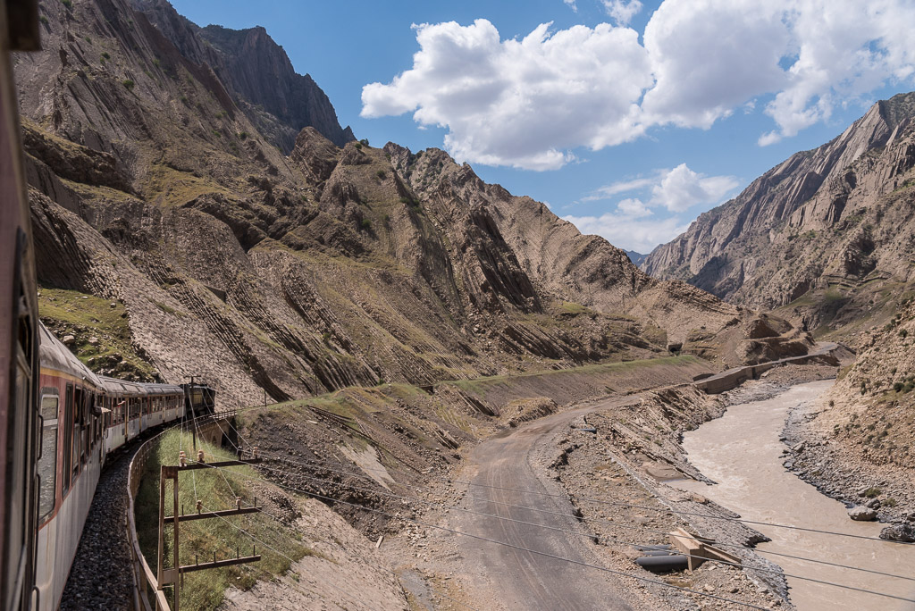
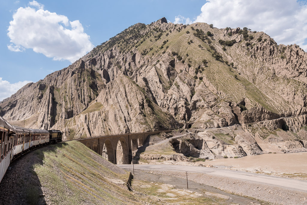
The most scenic railway trip
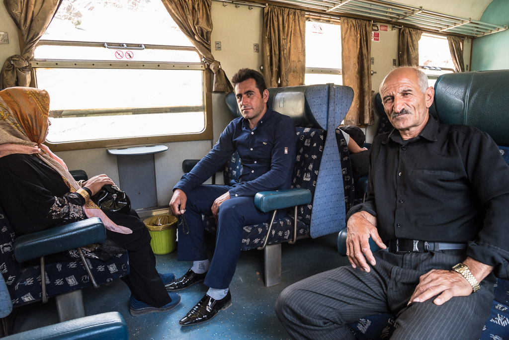
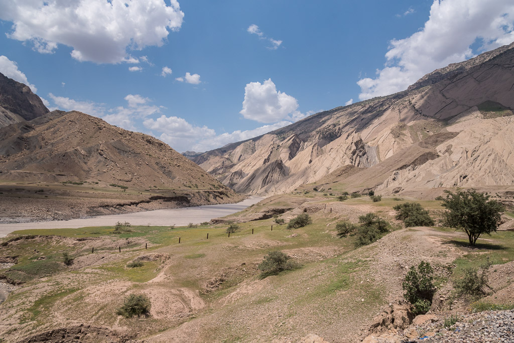
While melting in the heat of the Khuzestan-plain, where the temperatures exceed 50°C in the summer, I was craving some mountains with a cool breeze. More than 100km north, on the other side of the Zagros mountain range, a mountain named Oshtorankuh lured me with its beautiful lake and lush green meadows on its foothills. I didn’t think long about going there, especially after I found out that a super-scenic single track railway crosses the Zagros mountains connecting Andimeshk in Khuzestan with Dorud in Lorestan, less than 30km away from Oshtorankuh. Hopping on the train was like traveling back in time. With a jolt the old black diesel locomotive pulled the heavy carriages out of the train station. The train is the only connection to the outside world for several villages along the railway. Most passengers were taking huge bags filled with food and clothes to their families living in one of the tiny villages along the railway. The average age of the people on the train was pretty high, which gave me the impression that the youth is leaving these beautiful, but remote places. Soon after leaving Andimeshk, sellers with bags and trays walked up and down the carriages offering food to those who didn’t prepare for the 5-7h journey. I was the only obviously foreign looking person that boarded the train and as always people wanted to inquire what brought me to their region, what places have I visited and where I was planning to go. The landscape outside the window changed quickly. The fields of Khuzestan with their golden grain gave way to green meadows surrounded by steep, rugged rocks and mountains. Building the railway must have cost tremendous effort. Bridges over deep valleys alternated with endless tunnels. Those prone to vertigo should better avoid looking out of the window for too long 😉
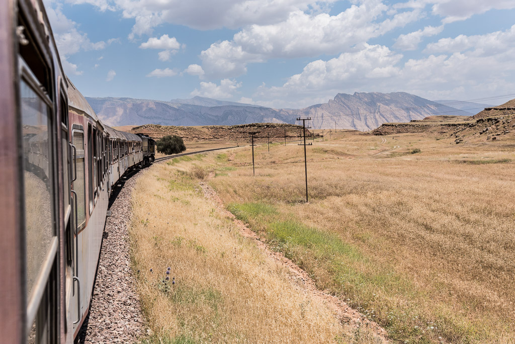
Leaving Khuzestan towards Zagros mountains
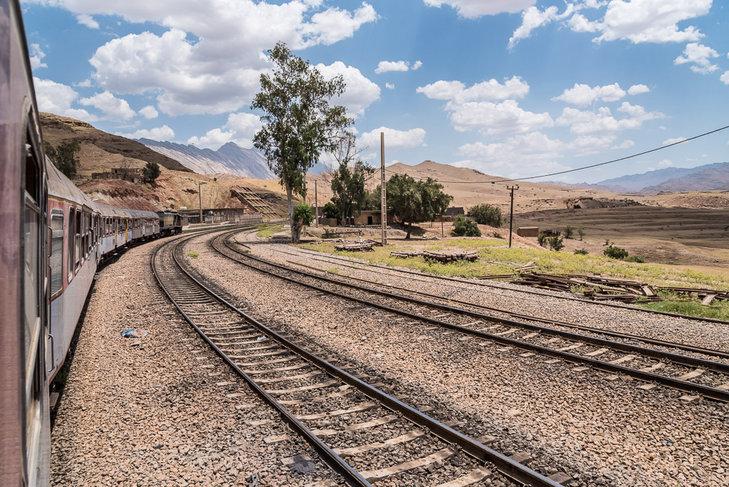
The train station of a small village
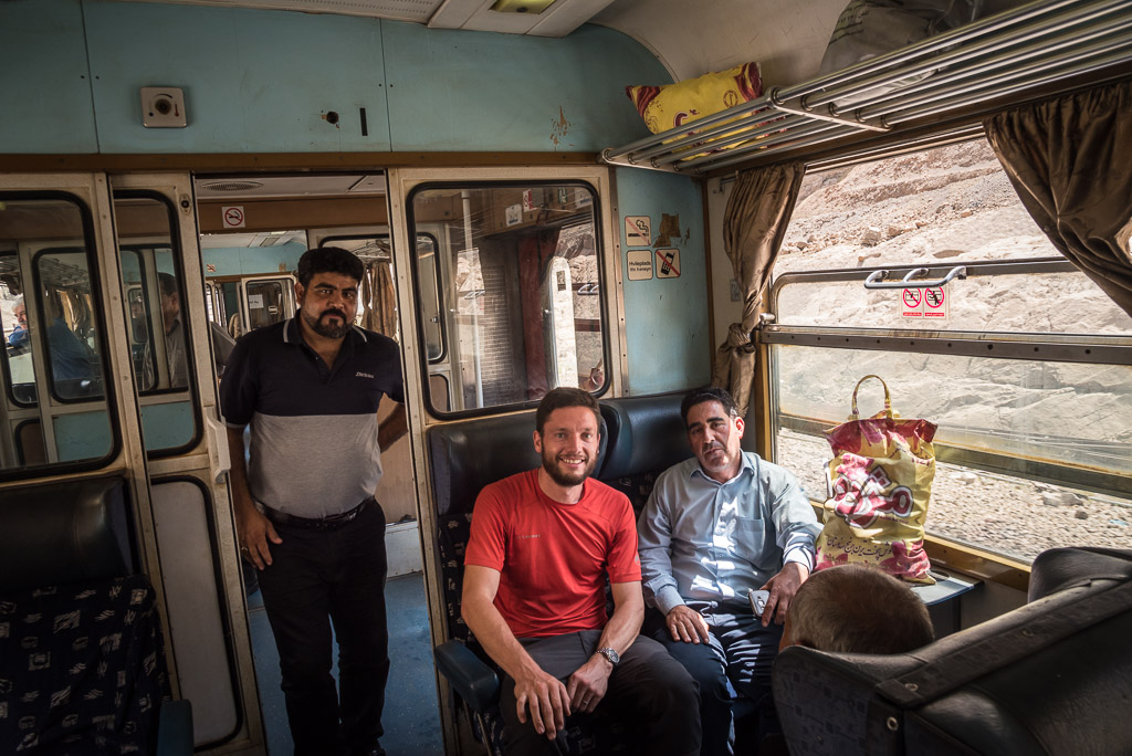
My fellow travellers
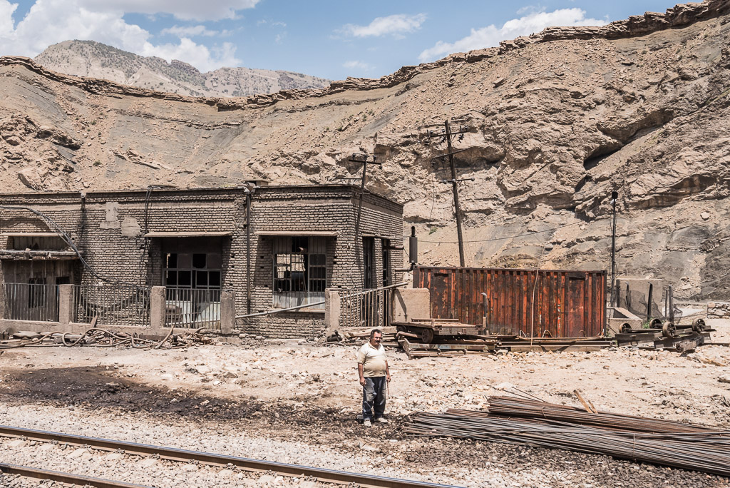
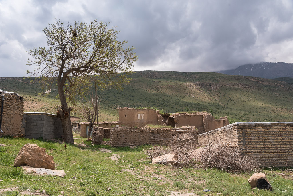
Not all villages along the way were nice and shiny 😐
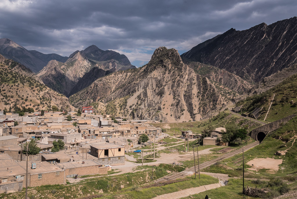
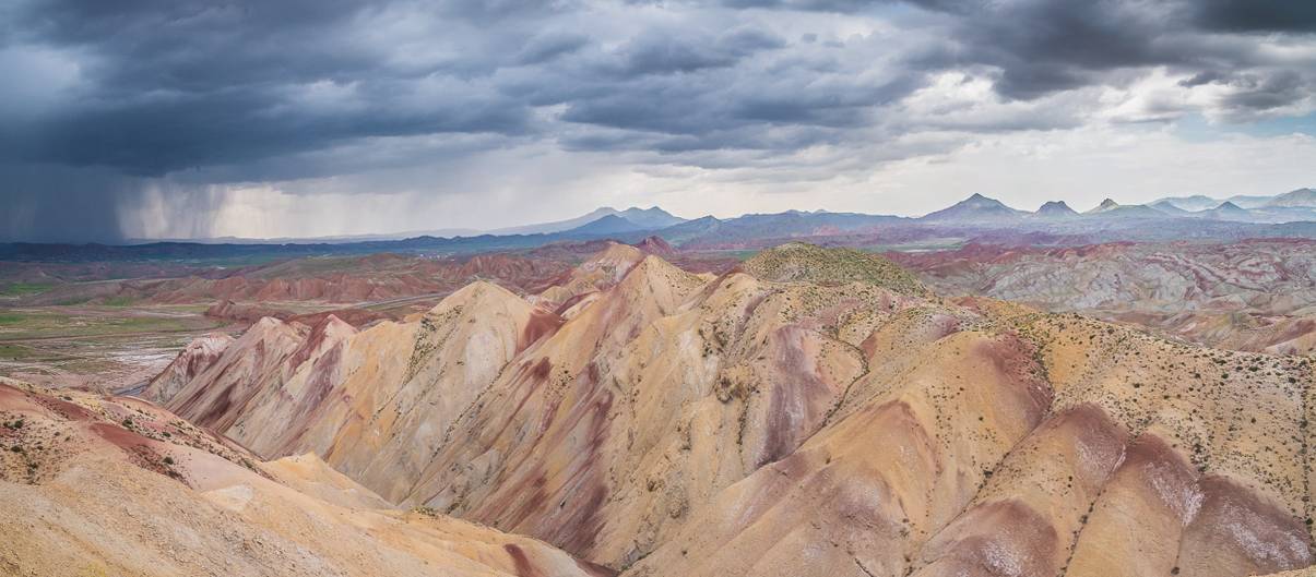
Thick and dark clouds indicated less stable weather on the north side of the Zagros mountain range
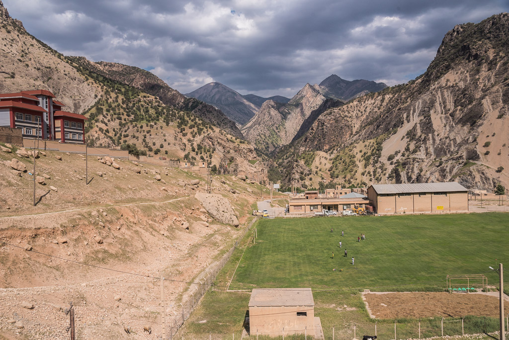
Probably most scenic football field in Iran
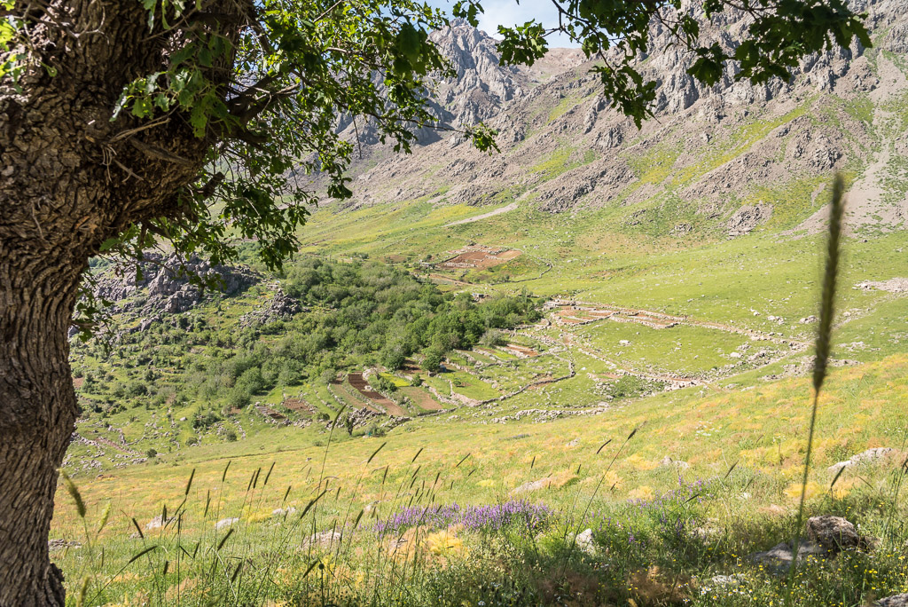
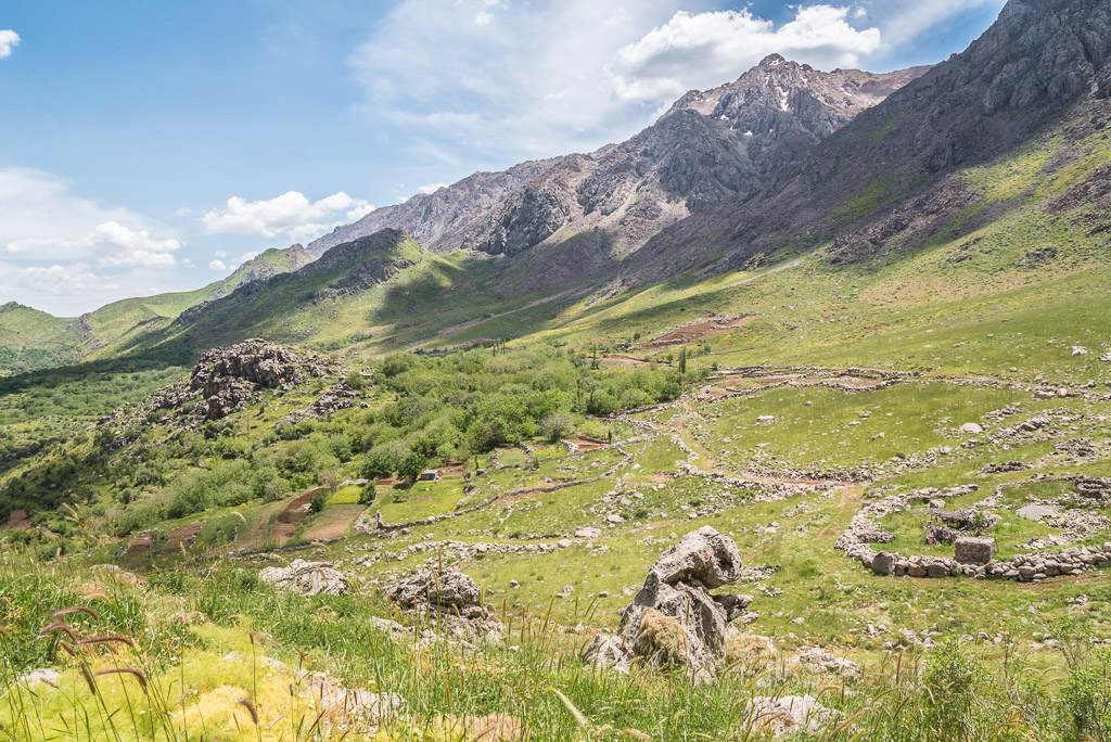
Oshtorankuh (4150 m)
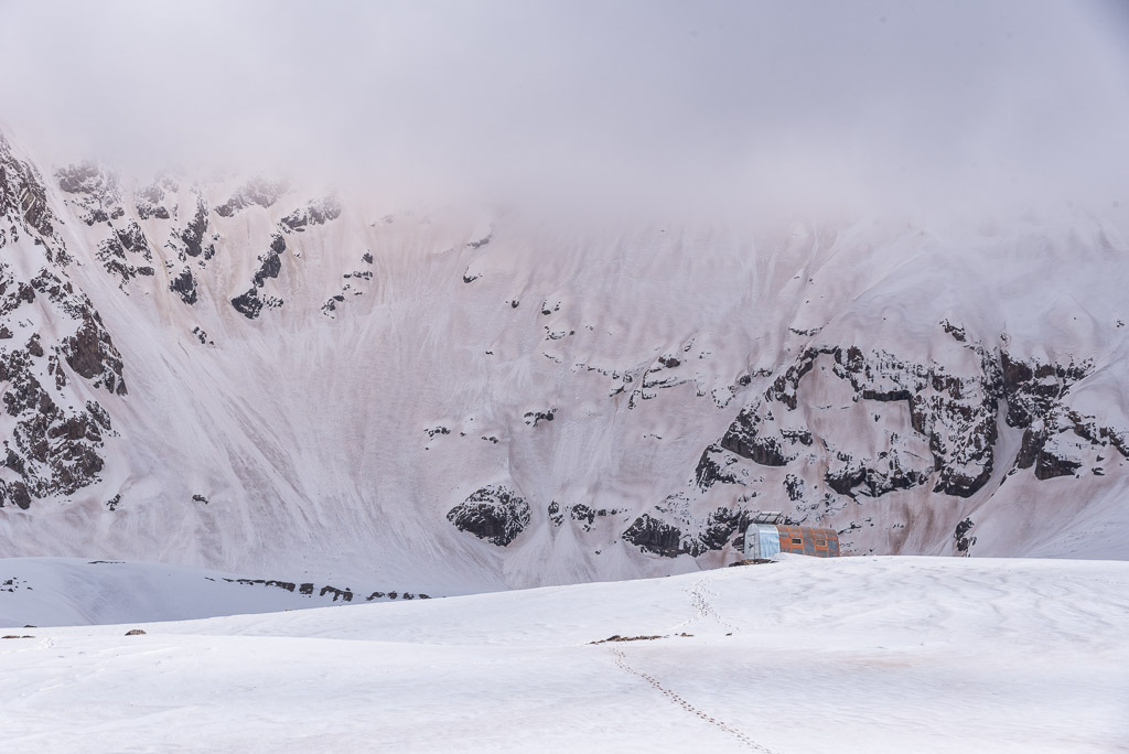
Using Telegram, at that time the most papular messenger app in Iran, I was looking for a companion to climb Oshtorankuh. Unfortunately, no one had time, but I found a mountaineer who confirmed that the GPS track I found on wikiloc existed. Although I initially wanted to ascend the mountain from lake Gahar, I had to abandon this idea as the entry to this area was prohibited at that time in order to protect bird breeding sites. It was said that two shelters were on the way to the top, but I played it safe and took my tent anyway.
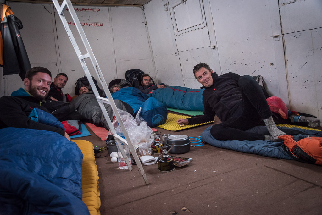
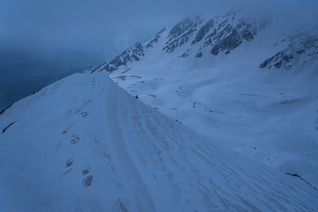
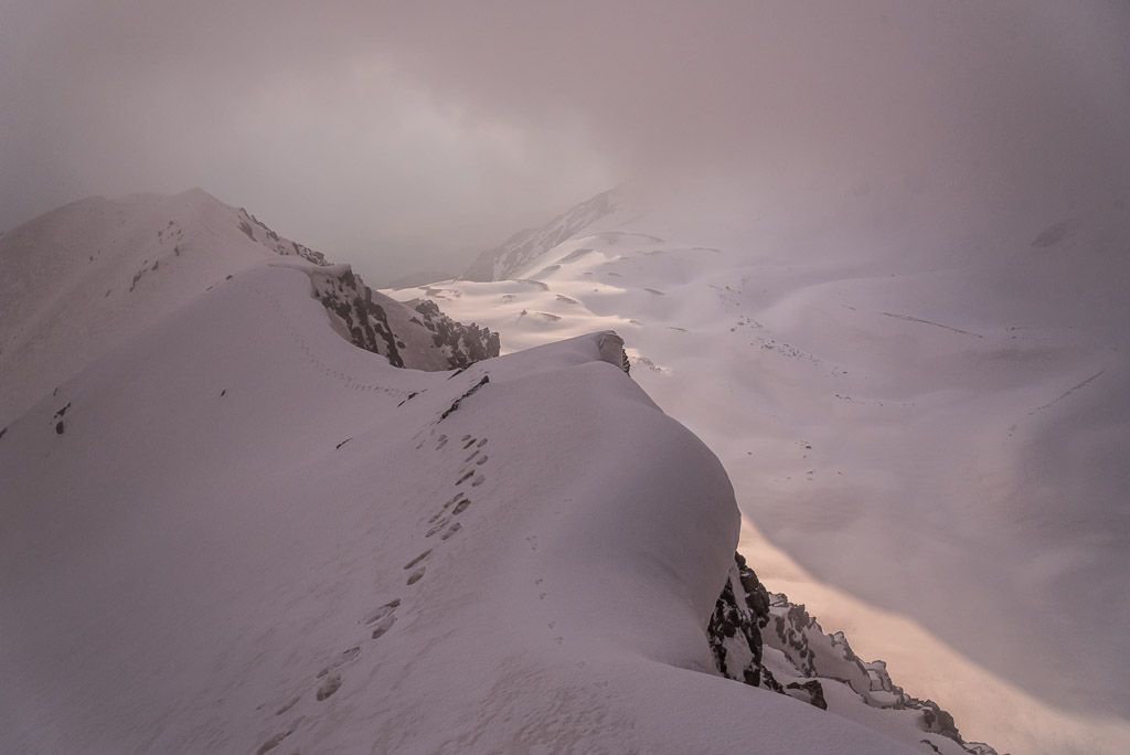
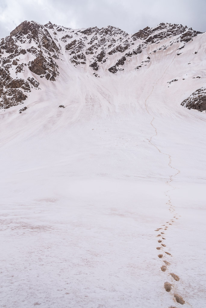
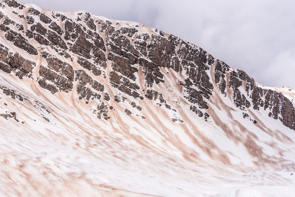
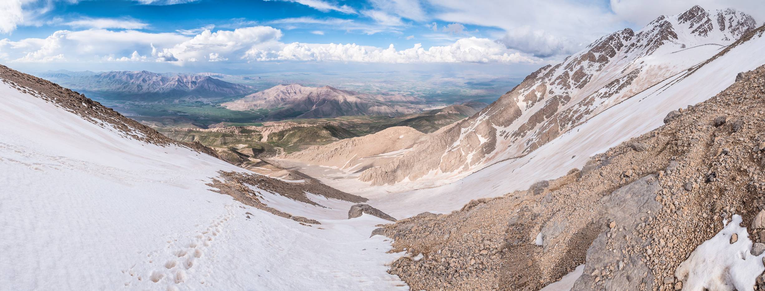
It was already noon when I started in the village at the trailhead at 1740m and as huge clouds were quickly building up over the mountain peaks, I was afraid that they could turn into a thunderstorm. Luckily, I was spared this time and I could reach the second shelter on 3630m well before sunset. I was quite surprised that everything above 3500m was still covered by a thick snow layer. The best season for hiking and climbing was said to begin soon, but I was sure that this amount snow would not melt at least for a month. When I opened the door of the cabin, I looked into the eyes of five people in sleeping bags. It was such a nice surprise to meet the English speaking guys from Slovakia and Czech Republic and I realised how much I missed a decent conversation. Unsurprisingly, I didn’t sleep much at that altitude. The weather didn’t look promising as clouds were covering the peaks all evening and it didn’t get better until morning. I left the shelter at 5am, one hour before sunrise, in order to reduce the risk of getting into a thunderstorm. The other five guys didn’t want to hurry and wanted to a have proper breakfast first. I didn’t find any tracks in the snow but blamed the wind and fresh snow for covering them. When the sun rose behind thick clouds I reached the U-shaped ridge leading over three smaller peaks to the highest spot. The snow was soft and I had a reasonable grip without crampons. Later, when the clouds lifted slightly, I saw the group of five guys going towards the other side of the U-shaped ridge following a barely noticeable track uphill. According to the GPS track I was following, I should be crossing the lower peaks before reaching the highest one. The other route seemed to reach the highest peak directly by ascending a wide and slowly rising ridge. It was then when I realised that I had chosen the much more difficult ascend, most probably passable only in snow-free summer conditions. However, as it was too late to go back and take the other way, I decided to continue. Before the first peak, the ridge became quite narrow and I had to carry on very carefully without crampons. When I reached the first peak at 4050m, visibility was well below 50m making it difficult to find the right way that required climbing down about 50m. The clouds lifted for a moment when I reached the col below the third peak and I realized that the weather was not promising. Huge cumulus clouds were rising, a typical sign for an upcoming thunderstorm. The climb to the third peak would have been nice without snow but was quite difficult without crampons. It took me ages to climb the first 10m so I decided to stop and return to the shelter. Fortunately, I didn’t have to return via the same way and could descend directly from the col as the way was not too steep and covered with deep and soft snow. The Slovakian/Czech group confirmed my mistake after their return and reported that their way to the highest peak of Oshtorankuh was pretty easy. Soon after I left the shelter to descend, the expected thunderstorm hit Oshtorankuh and forced me to the ground. Luckily, the thunder disappeared quickly and I arrived safe and dry back in the village.
The trailhead in the village of Tian
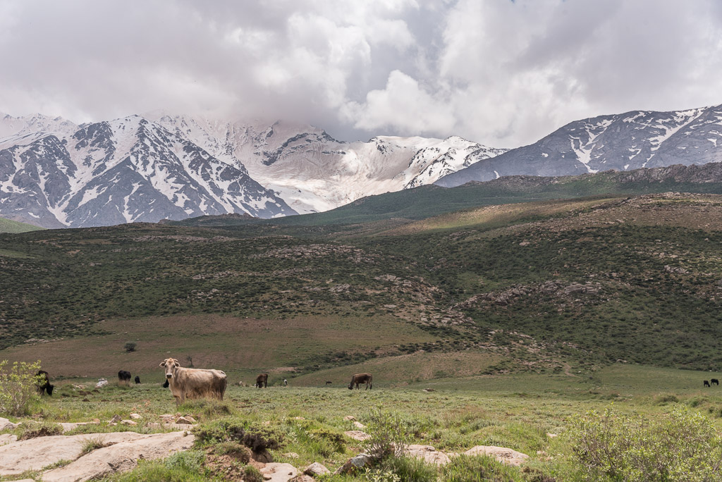
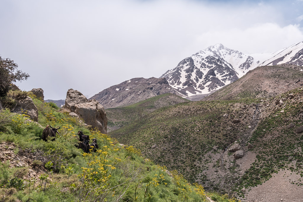
Despite though conditions, many shepherds let their sheep and some cattle graze on the hillside meadows
The shelter surrounded by the peaks of Oshtorankuh
Climbing Oshtorankuh was part of their acclimatisation for Mt Damavand (5609m)
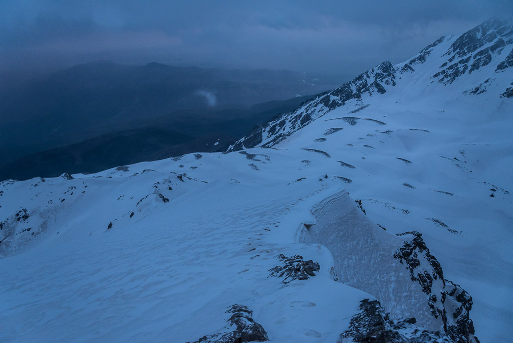
I was already on the way to the first peak of Ostorankuh when the first light of dawn found its way through the thick clouds

I hoped the rising sun would disperse the clouds quickly, but I was too optimistic…
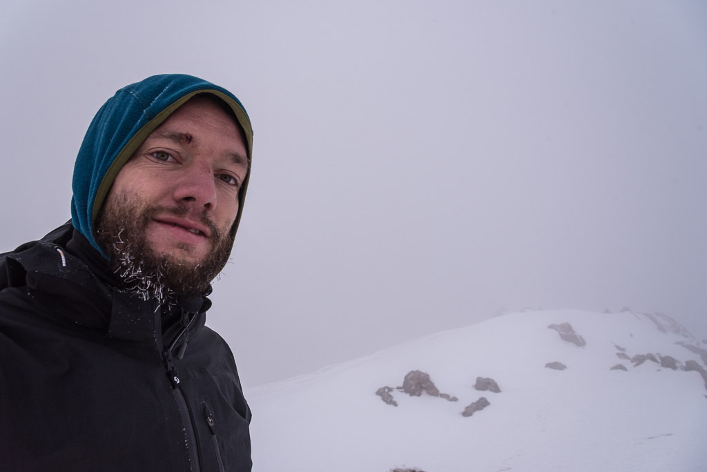
I was quite disappointed when I reached the first peak and had no visibility. The beard did a good job of keeping my face warm 😉
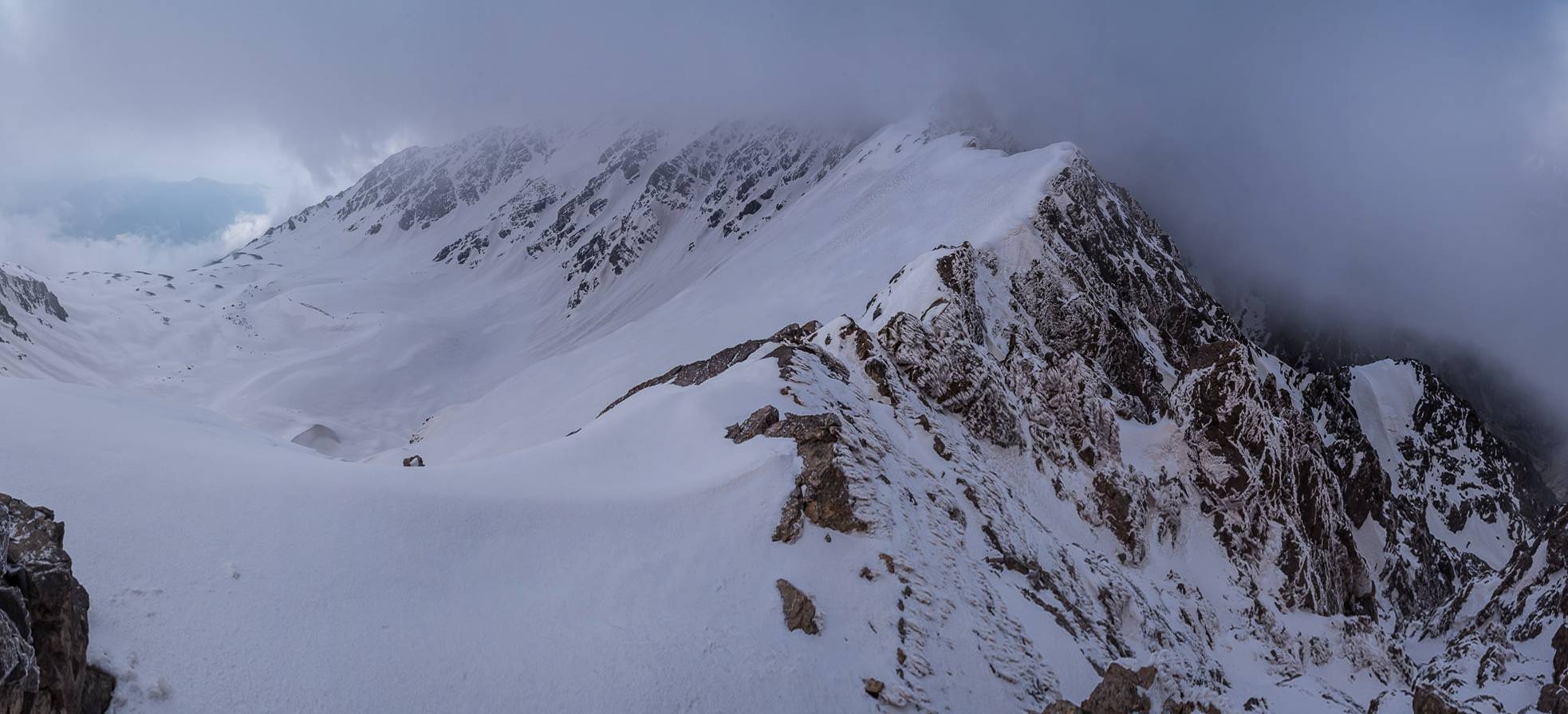
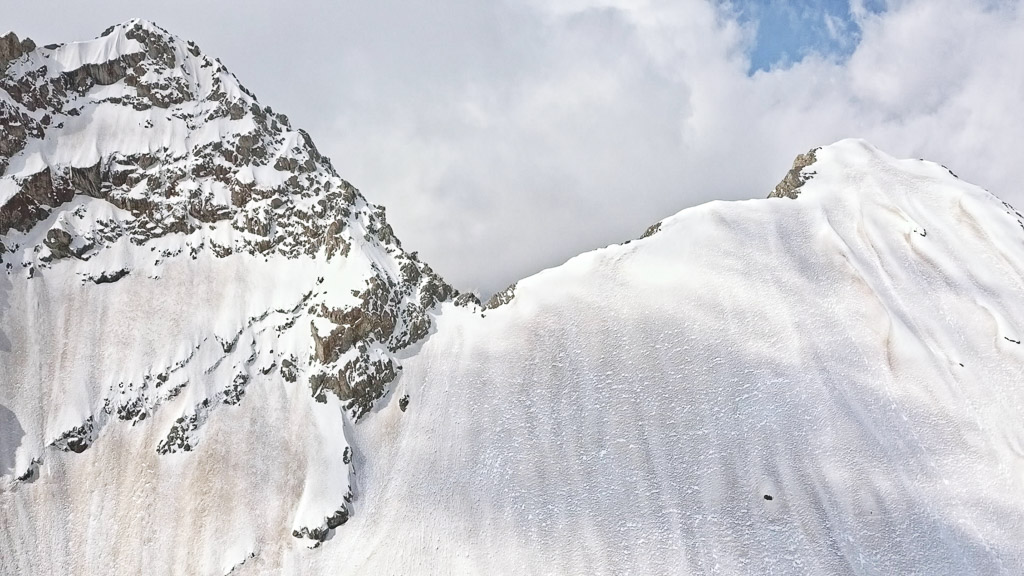
The cloud layer was slowly lifting and I could see the grim ridge that continued to the highest peak. I wished I had crampons with me…
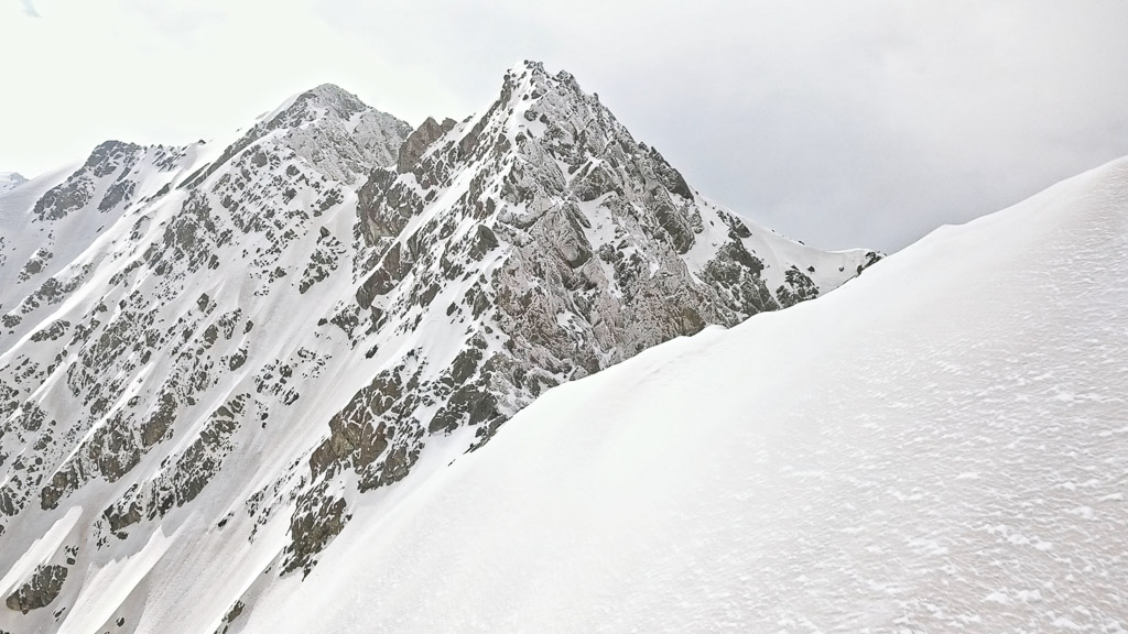
Finally, the clouds lifted and I could see the first two peaks that I left behind
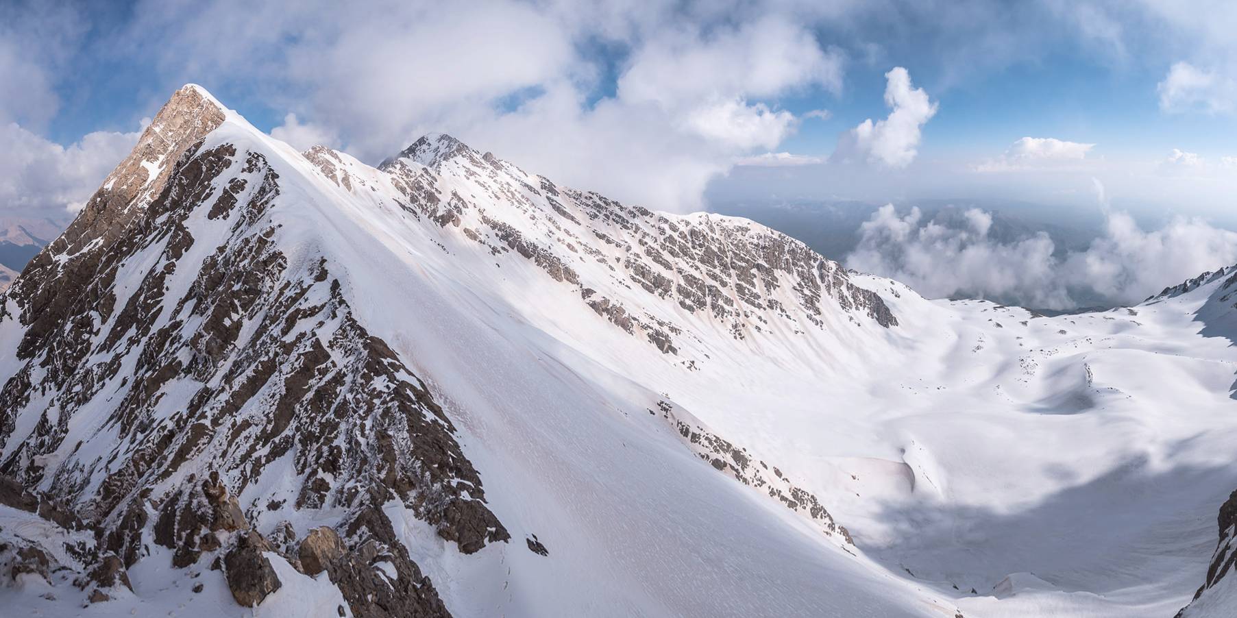
The eastern ridge leads directly to the highest peak
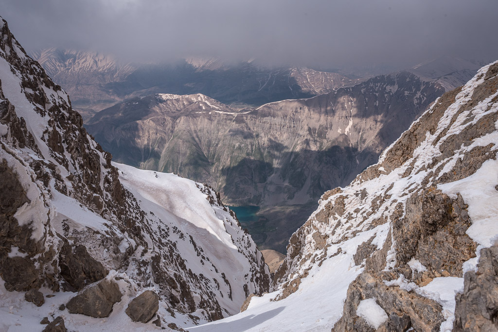
For a few minutes I could see lake Gaher
I took a rest in the col after deciding to abort the ascend of the third peak (left)
Analyzing the aerial pictures confirmed my decision to stop the tour. Moving further would have been too risky without crampons in these conditions with unstable weather.

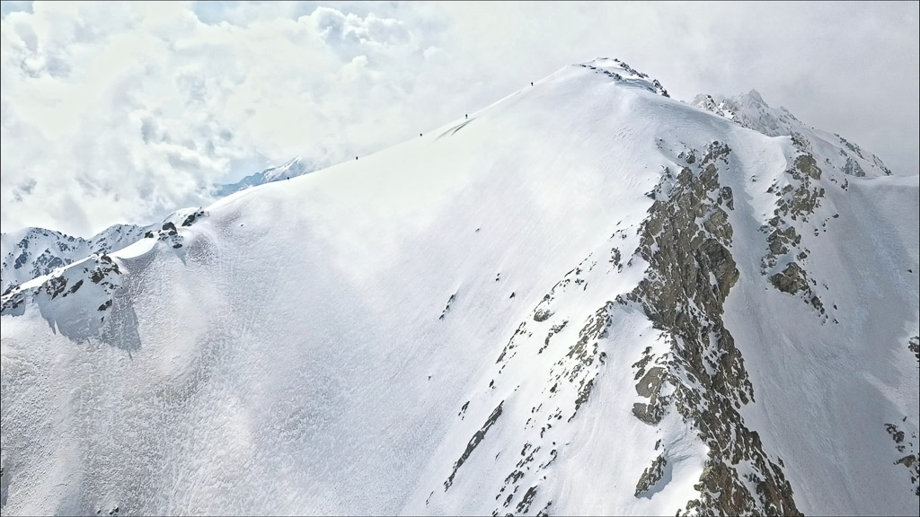
Instead of going there myself, I sent the drone to the highest peak of Ostorankuh 🙂 It was perfect timing to capture the other five mountaineers just below the peak
From the col I took a shortcut back to the shelter
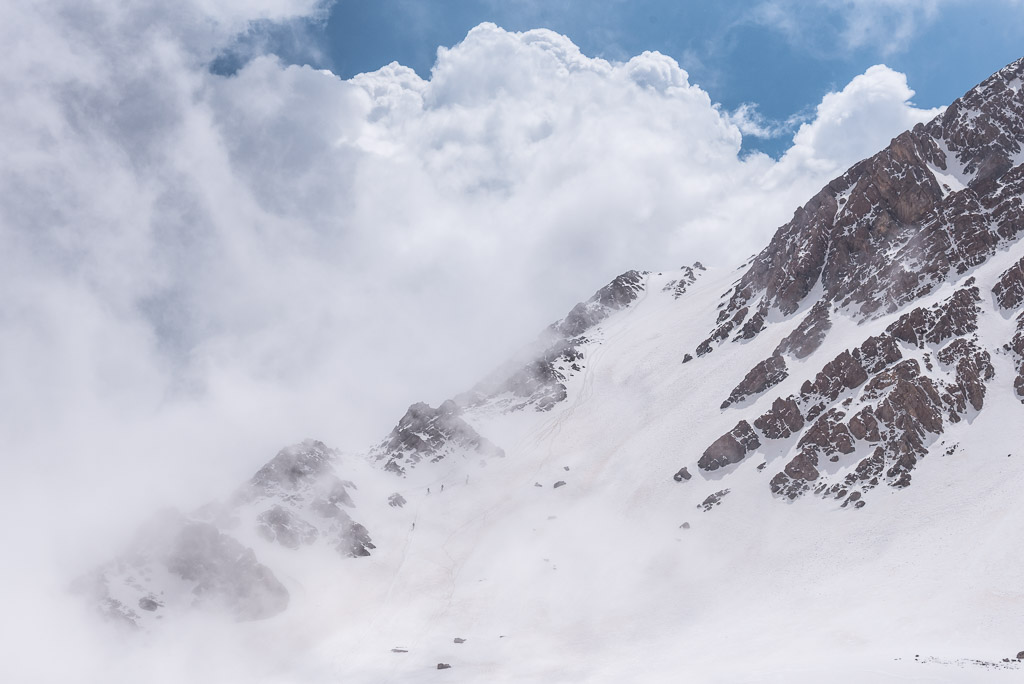
Huge cumulus clouds were forming quickly while I waited for the group of five to return

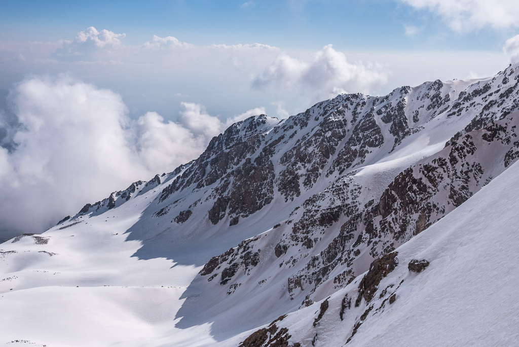
The western part of the Oshtorankuh ridge
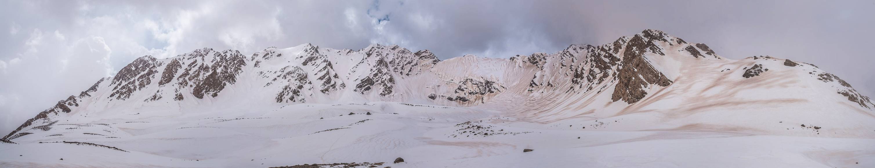
The peaks of Oshtorankuh
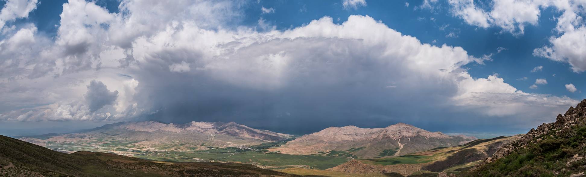
A massive thunderstorm was building up when I was on my way back
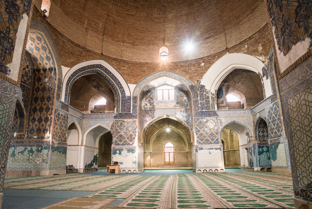
Kermanshah and Kurdistan
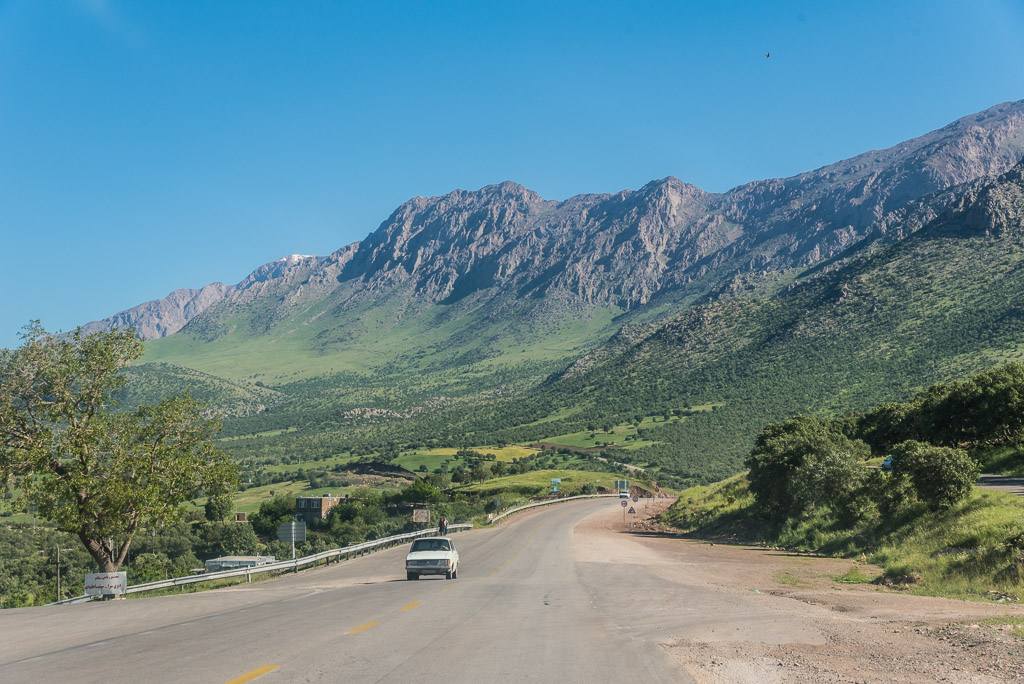
The day I left Dorud towards Kurdistan was the first day of Ramadan. For those who are not familiar with it, Ramadan is the ninth month of the Islamic year when adult Muslims do not eat, drink, smoke or have sex from dawn till dusk. Exception is made for those who are ill, elderly, pregnant or breast-feeding or are travelling. Adherence to Ramadan is enforced by law in Iran and no restaurants or cafes are open during the day. Of course, you can still buy food and drinks everywhere, but you are not allowed to consume them in public. Some hotels and truck stops along the high ways use the exception for travellers to offer meals. Otherwise, there are only very few restaurants, usually located in backyards, that serve food behind covered windows. However, throughout the country, I saw many people disappearing into the entrances of those restaurants, hiding in backyards or walking into an empty street to eat and drink. I followed their example, but felt like a drug addict or a smuggler.
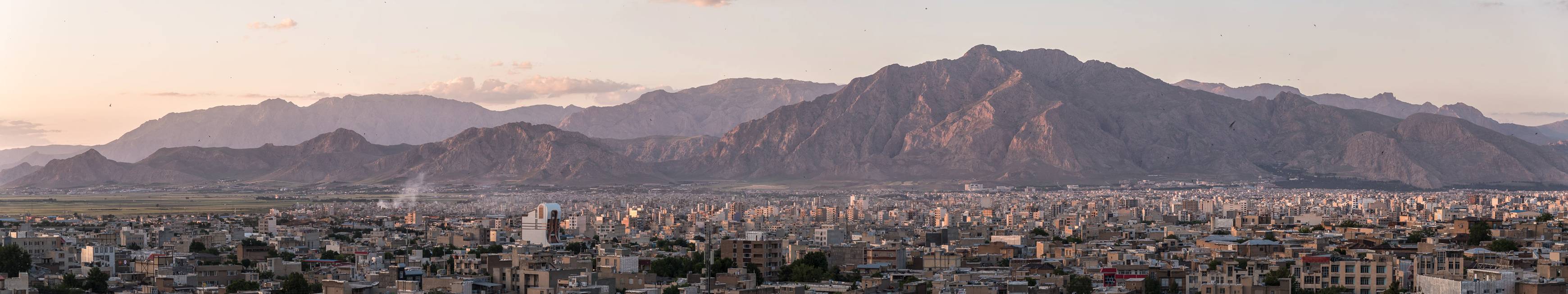
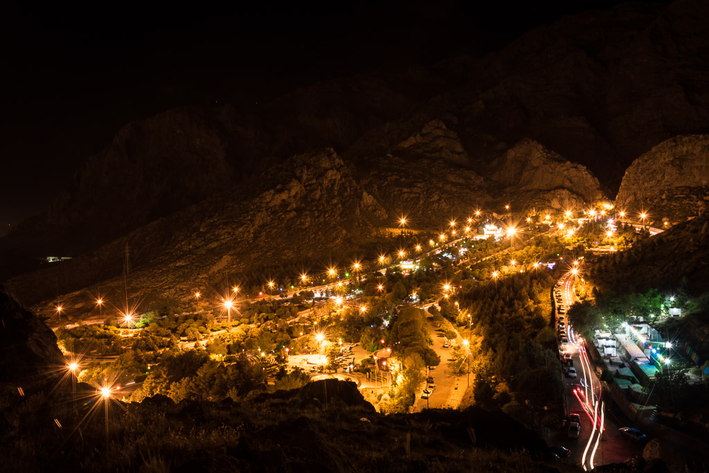
The panorama of Kermanshah

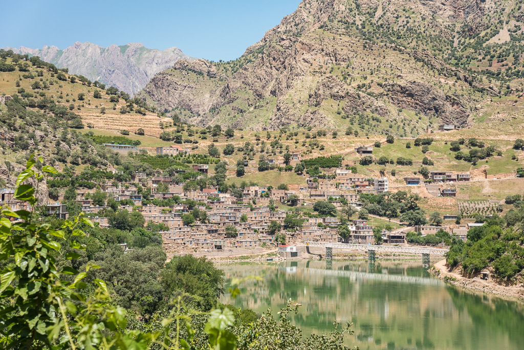
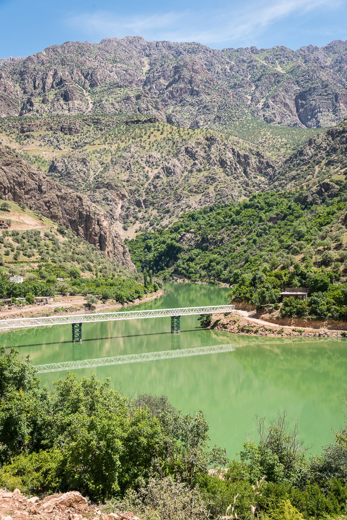
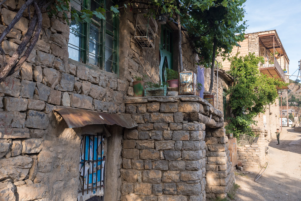
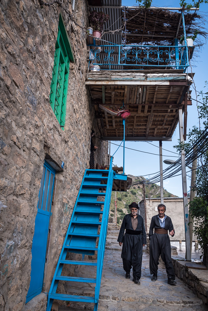
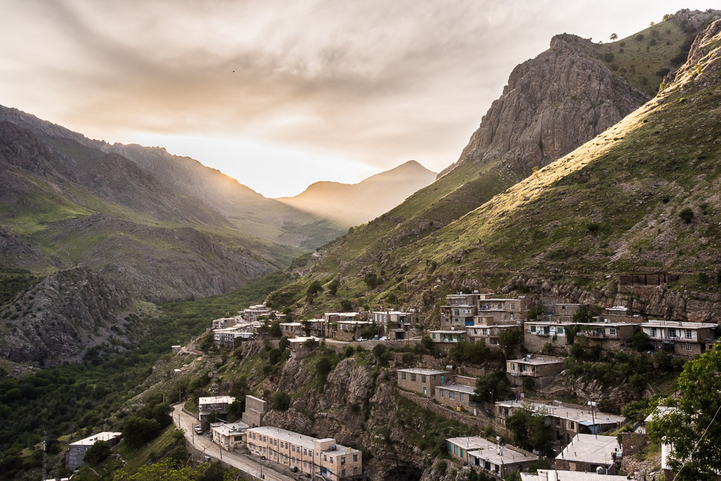
The picturesque village of Uraman takht is nestled in the mountains of Kurdistan
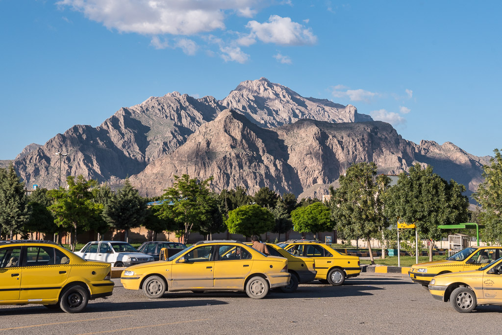
Quite a scenic taxi stand
A park and picnic place surrounded by mountains
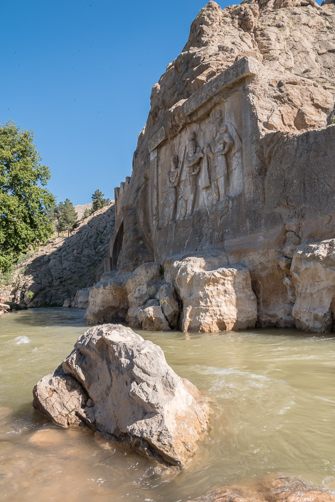
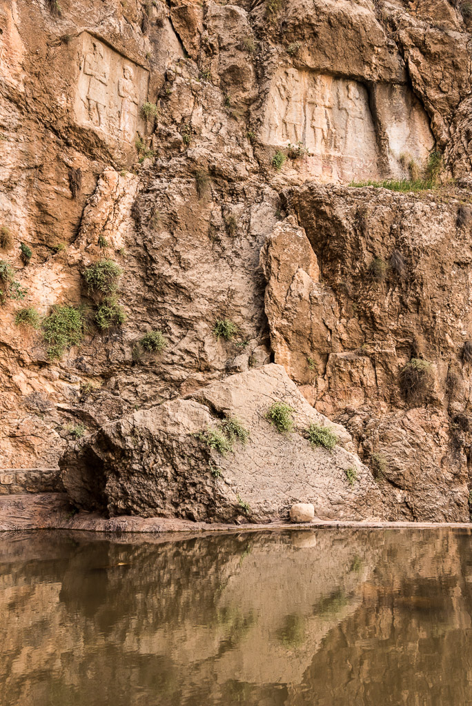
Tagh Bostan rock reliefs from the era of Sassanid empire (4th century AD)
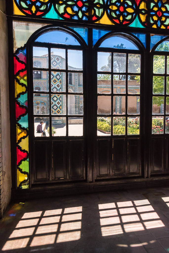
Inside Tekyeh Moaven al-Molk
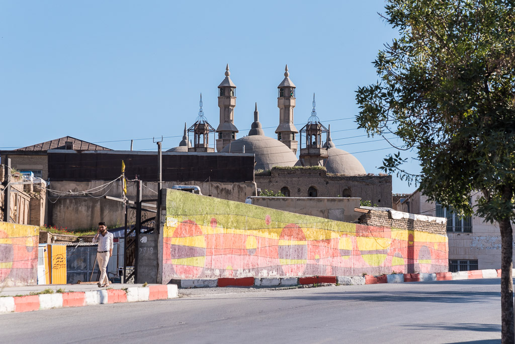
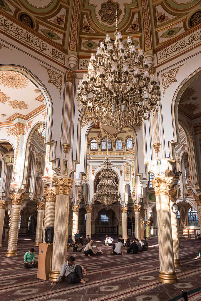
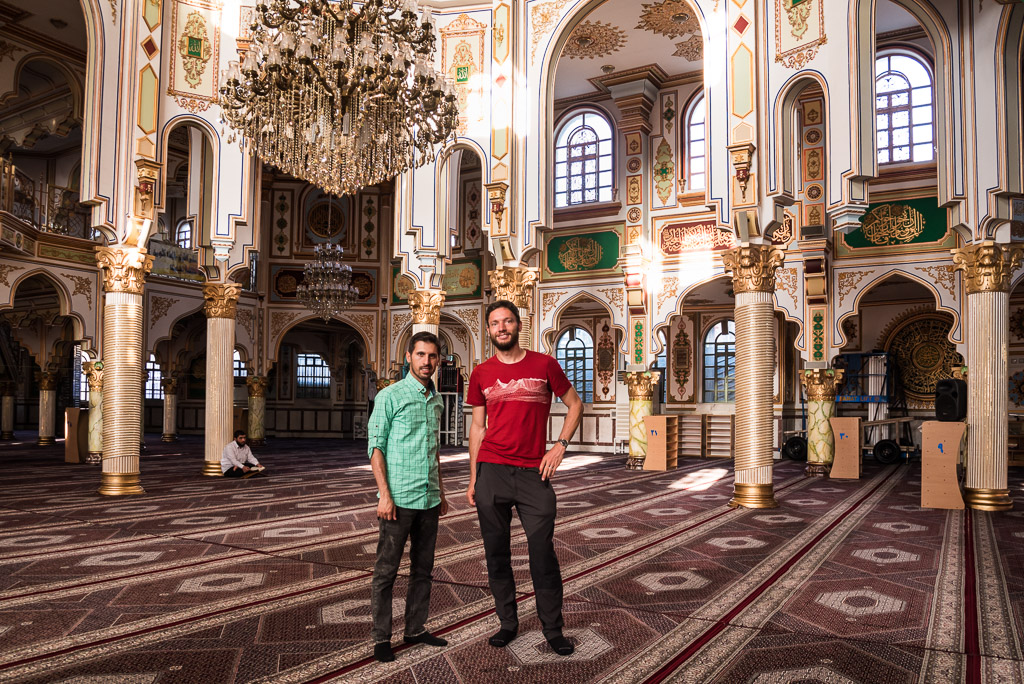
Inside Jame-Shafeie mosque, the first Sunni mosque I visited in Iran. Kermanshah is a cultural and religious melting pot with a majority of people speaking South Kurdish.
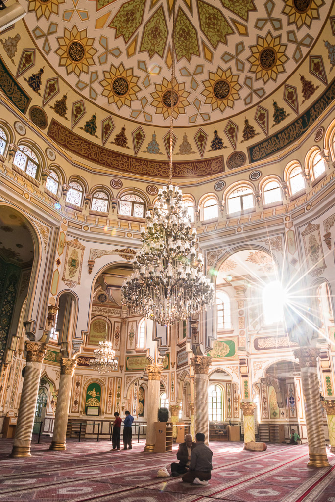
Dozens of columns, bright-coloured decoration as well as gold reminded me of a church
It is Amar’s favourite mosque
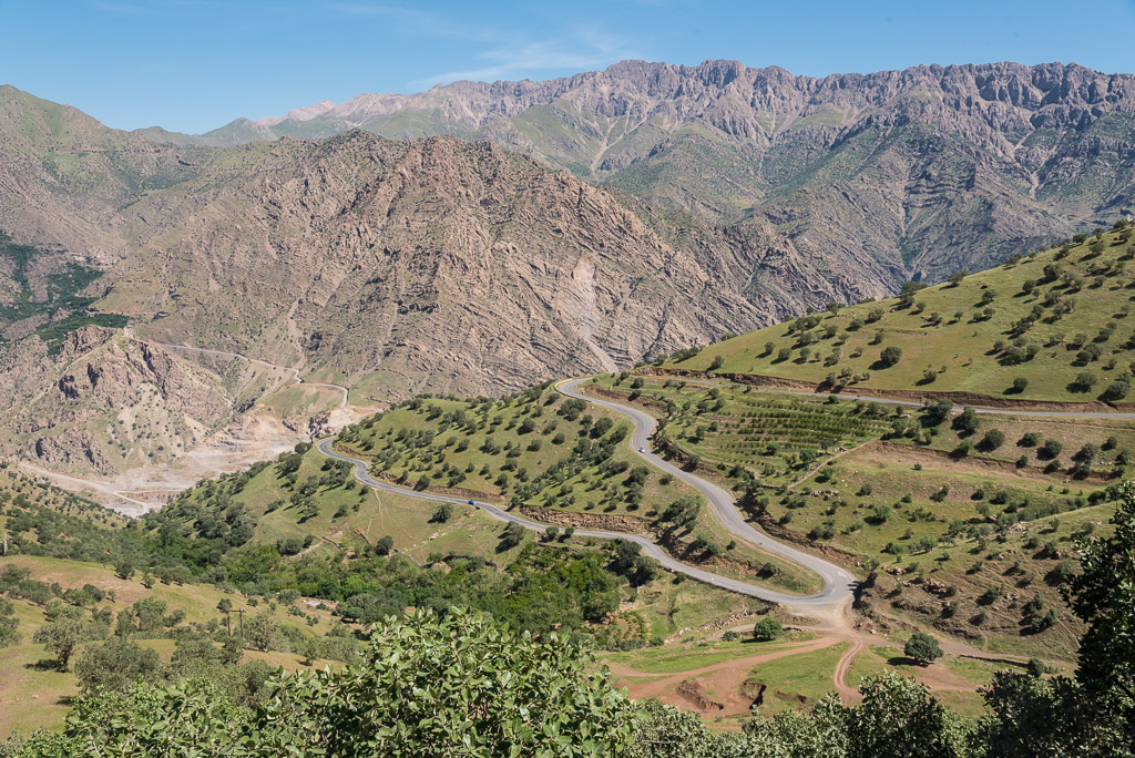
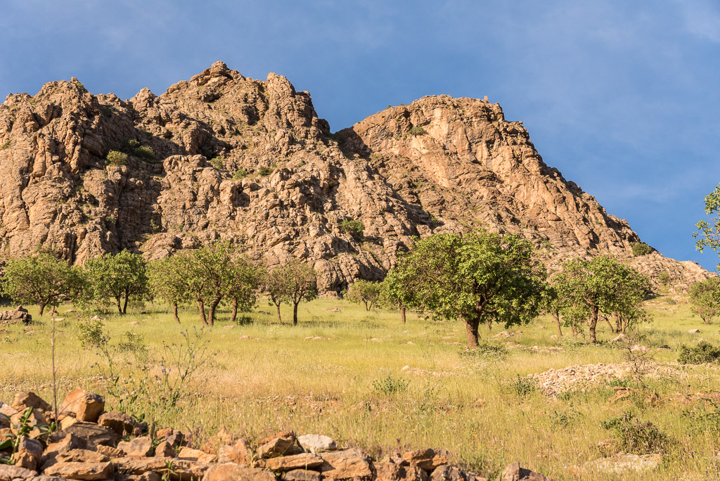
Going deeper into Kurdistan and its beautiful landscapes
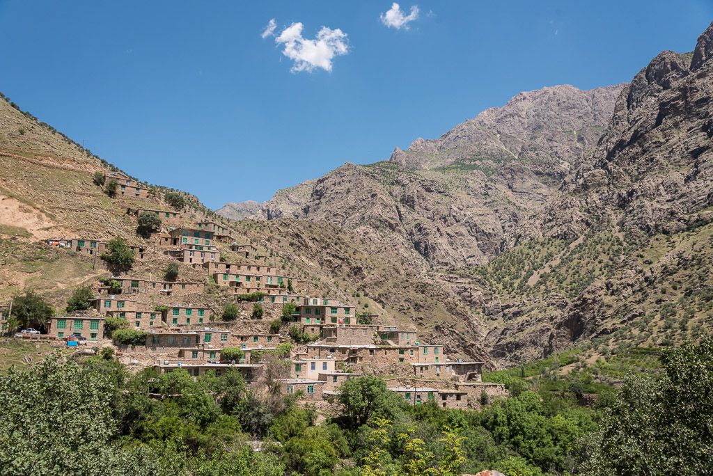
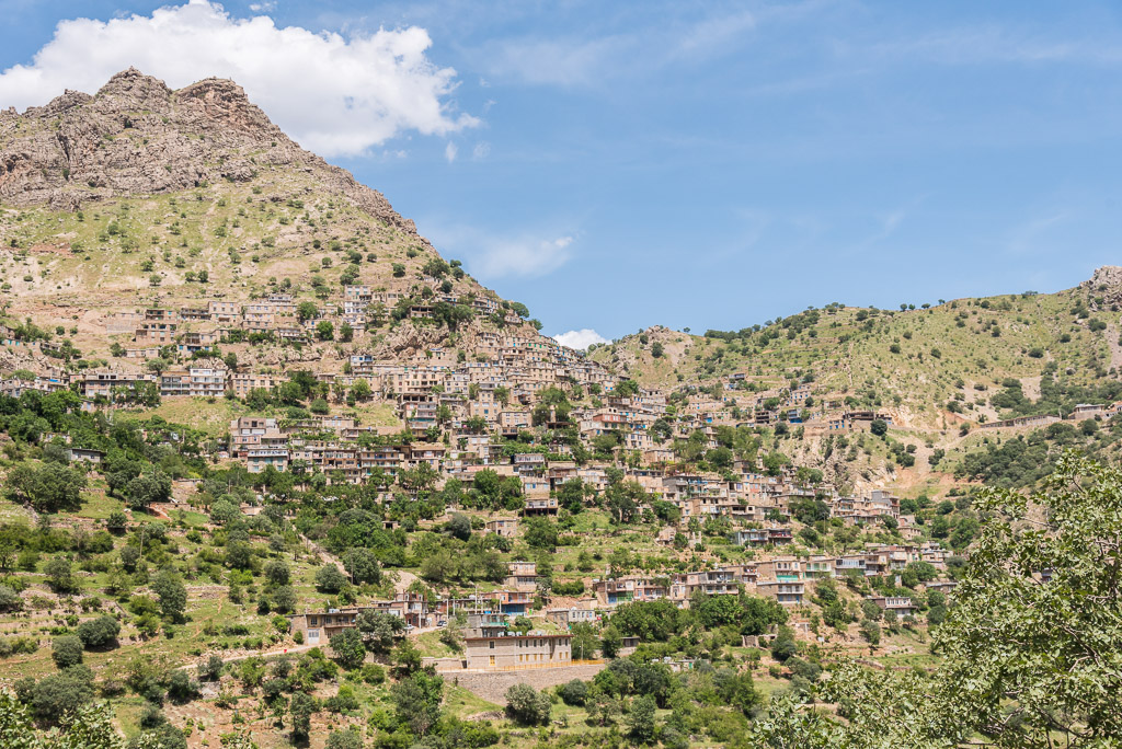
The village of Uraman takht
… and its inhabitants
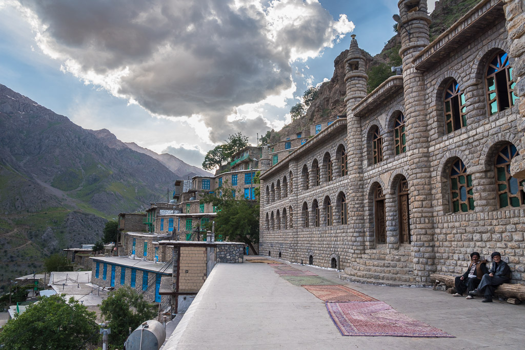

Sunset in Uraman takht
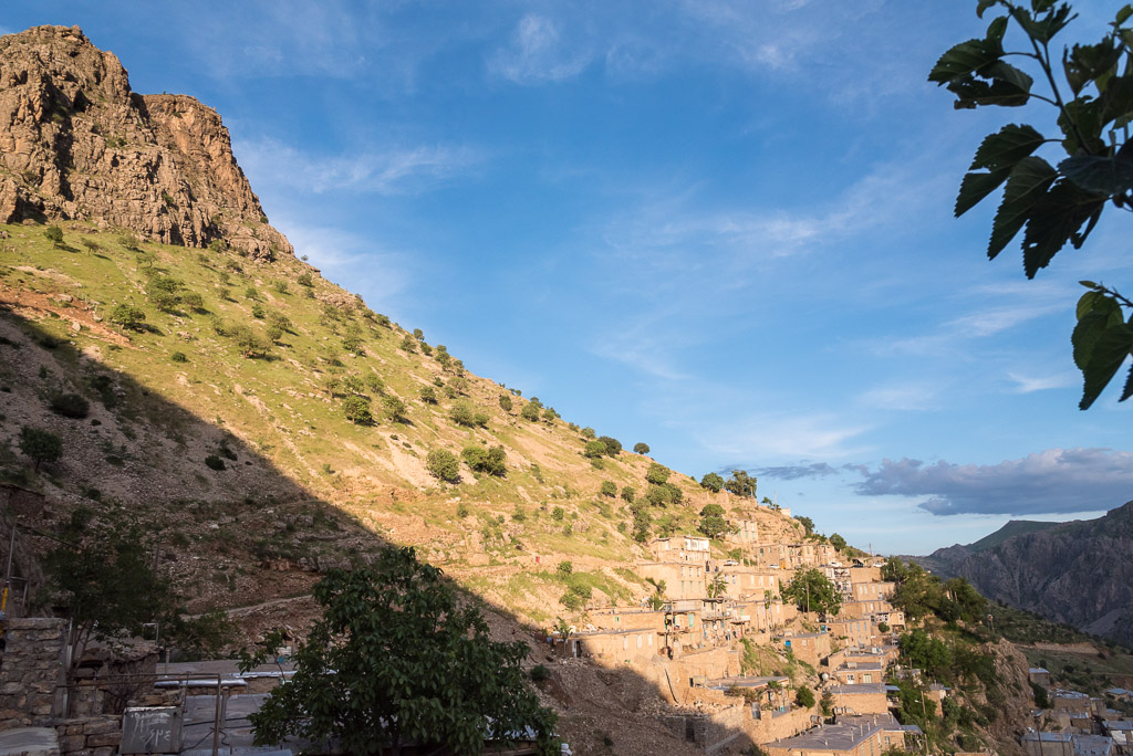
In the morning I hiked to the top of the mountain ridge west of Uraman takht. On the way was this tiny https://qarshi.com/bokstaven-h/index.html , isolated village with just a handful of inhabitants.
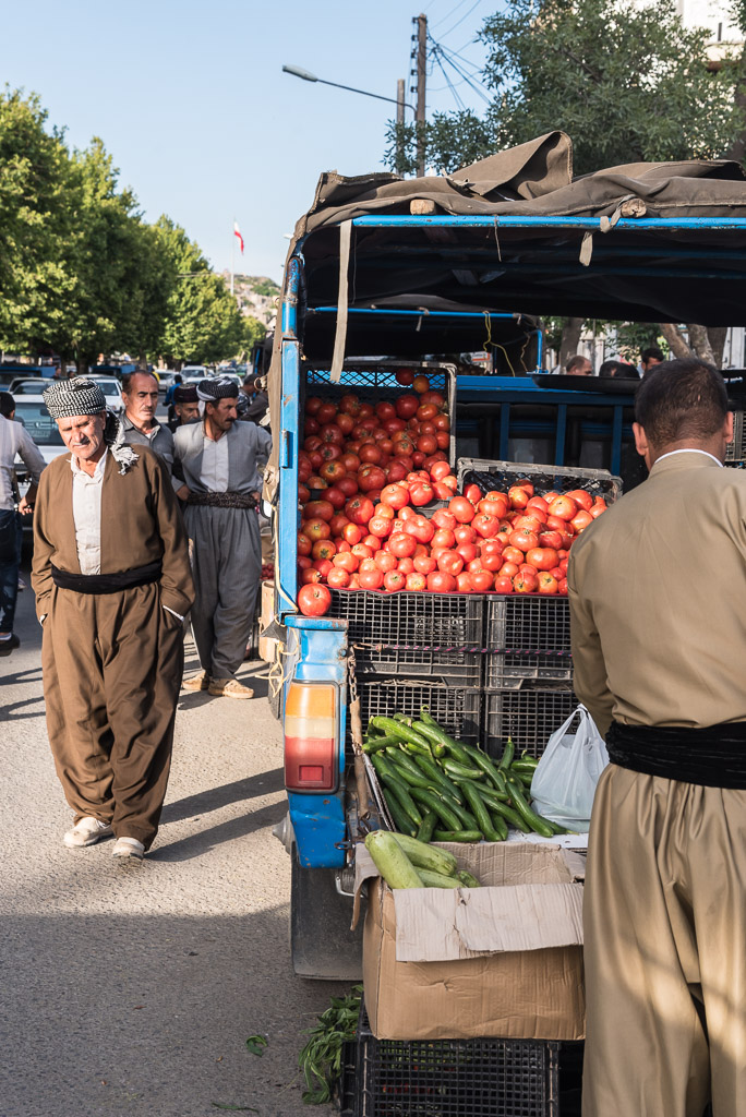
Street market in the city of Marivan
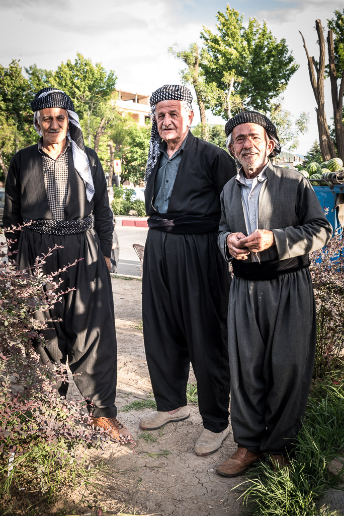
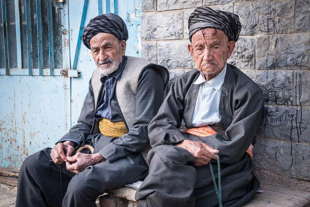
Many Kurdish man wear traditional Kurdish clothes, at least the famous „baggy pants“
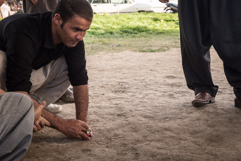
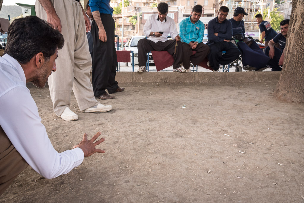
A group of men playing Klayan. It looks like a Kurdish version of Petanque, using marbles instead of metal boules.
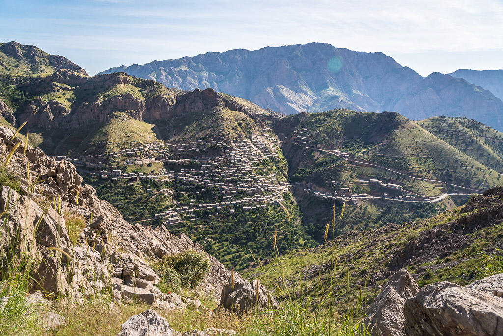
Another nice view of Uraman takht

Lake Zrebar on the fringes of Marivan
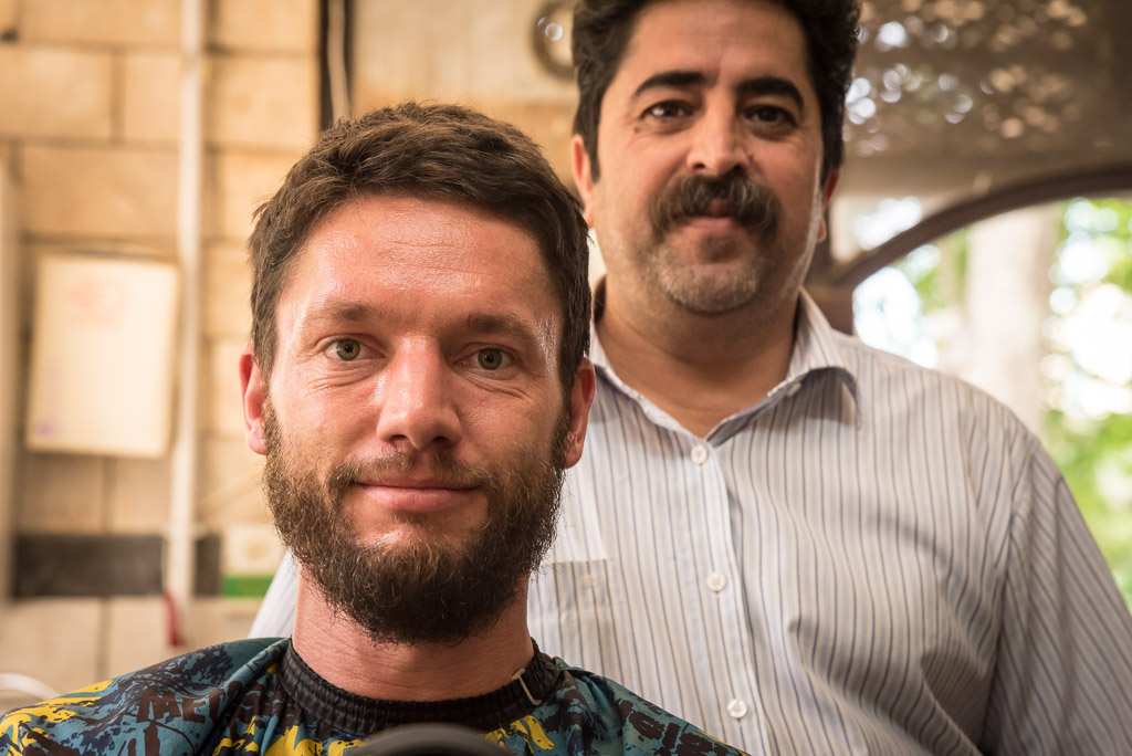
Obviously, I was in need of a barber 😉
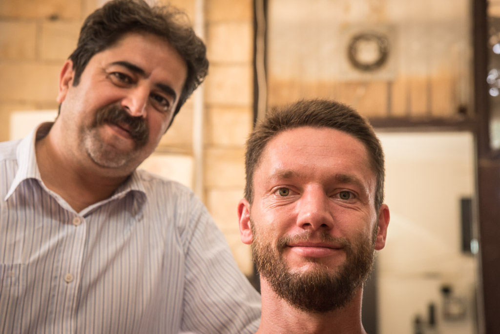
…and he did a really good job, considering the lack of a common language 😉
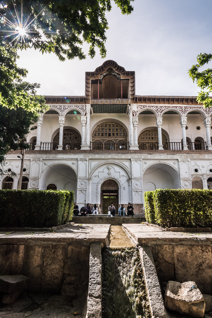
The Moshir Divan mansion in Sanandaj was unfortunately closed

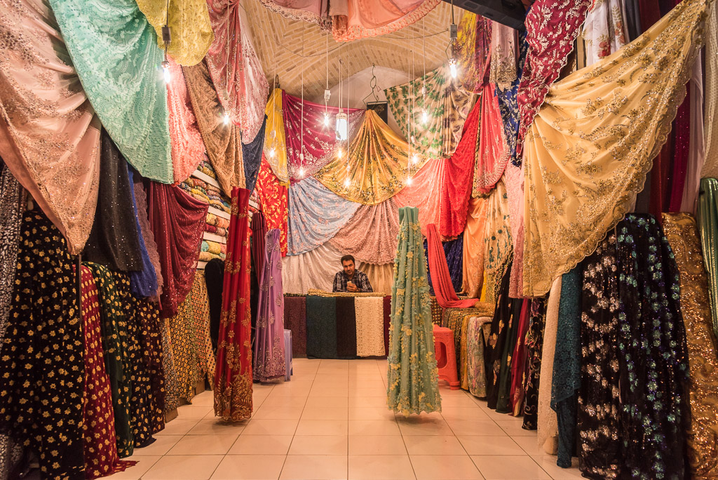
The bazaar of Sanandaj
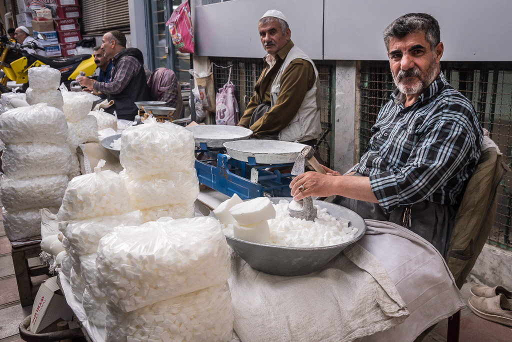
Men selling hand-made sugar cubes
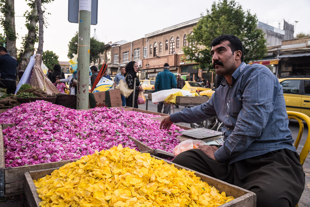
Petals are used in many dishes all over Iran

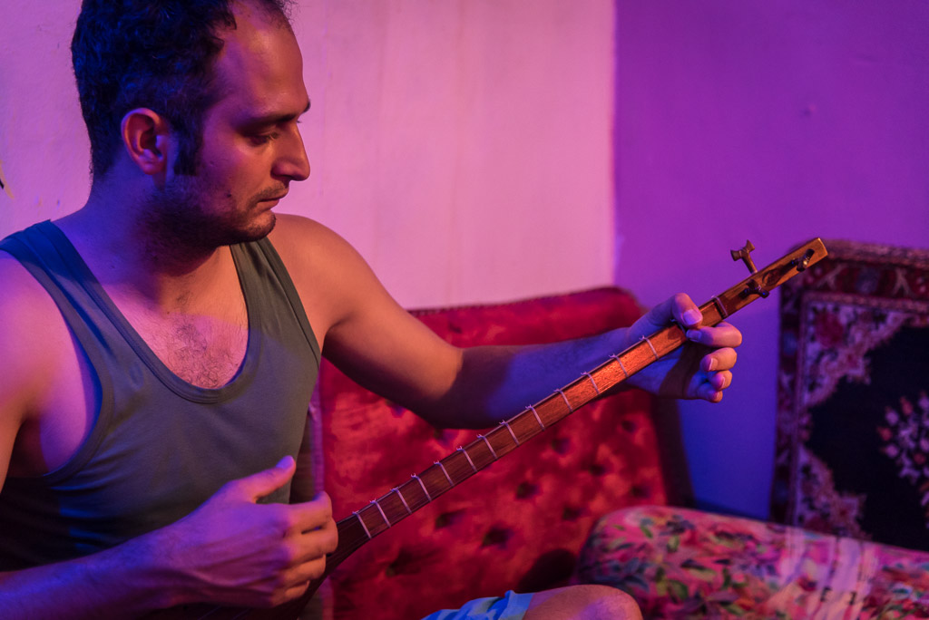
Chia playing the tamura
In Kermanshah I stayed with Amar who not only offered me a place to sleep, but also showed me around in town. We spent ours talking about everything under the sun and I’m still in contact with my congenial friend.
From Kermanshah I continued to the village of Uraman takht in Kurdistan, located in a remote valley close to the Iraqi border. Uraman takht is famous for its biyearly festival with traditional music and dances. Like many villages in this region, it is build on a steep slope creating a kind of terrace with houses being partially build on the houses beneath. My impression of the village was mixed. Though many houses appeared to be old, several had small shops selling virtually the same fake “traditional” clothes and shoes made in China and the same selection of dry fruits and honey. Tourism, in the absence of obvious foreigners I assume mostly local, has taken hold of the village and many villagers seemed to be bothered by it. Contrary to my previous experiences in Iran, I didn’t establish any relations with any villager.
In Sanandaj, the capital of the province Kurdistan, I found the open-hearted generosity that makes travelling in Iran memorable. Chia, a young Kurdish poet and writer, who I met on the street when I struggled to communicate with a taxi driver, spent two hours with me to help me get a new Iranian SIM card as my old one stopped working. That afternoon I hung out at Chia’s home talking about films (Bahman Ghobadi, the most famous Kurdish filmmaker used to live in the same street) and listening to Pink Floyd. The highlight was when Chia played traditional Kurdish music with a tamura (similar to tambura) for me. Follow him on Instagram to enjoy his tamura sessions or have a look in his latest book to get an insight into the Kurdish soul.
Tabriz
Near Tabriz, on the foothills of the dormant volcano Sahand, lays the village Kandovan which is popular with tourists thanks to its unique houses excavated inside the volcanic rock that looks like a termite mound. Unfortunately, Kandovan became too popular with tourists and today most of the village has lost its charm due to dozens of equally looking shops with the same Chinese made „traditional“ clothes that were also sold in Uraman takht.
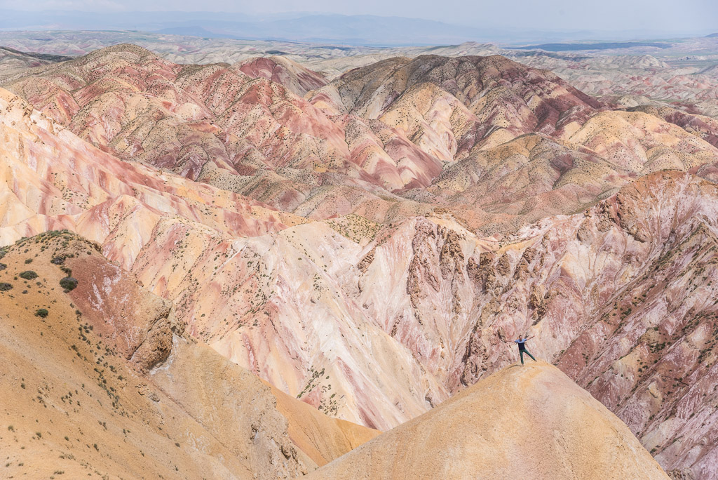
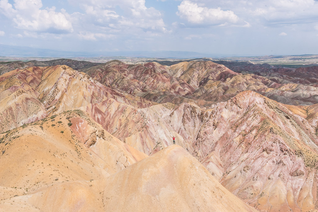
By chance, I heared about free walking tours through Tabriz offered by Mehdi (Tabriz Walking Tours). Mehdi’s knowledge goes far beyond Tabriz and he seemed to know all treasures of the province of East-Azerbaijan. He took me to the colorful mountains near Tabriz and the drying salt lake Urmia that today contains as little as 5% of the water it used to carry two decades ago. The decrease in water level is caused by human activity, namely the construction of dams on rivers flowing into the lake, pumping of groundwater from the surrounding area and significant decrease of precipitation caused by climate change. In the evening, Mehdi and his friends took me to his favourite Shisha bar where a heavy thunderstorm with hail tested the roofing of the courtyard and the „storm cover“ of the shisha pipes 😉 . Again, it was hard to leave a new friend, his hospitality and dozens of places to be discovered in the region. But, Alireza and Zahra, my friends from Tehran, who I met in Kampala were waiting for me…
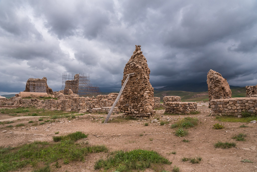
Ruins of the Takht-e Soleymān citadel
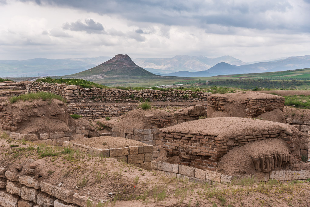
Not far from the citadel is the landmark volcanic crater named Zendan-e Soleyman
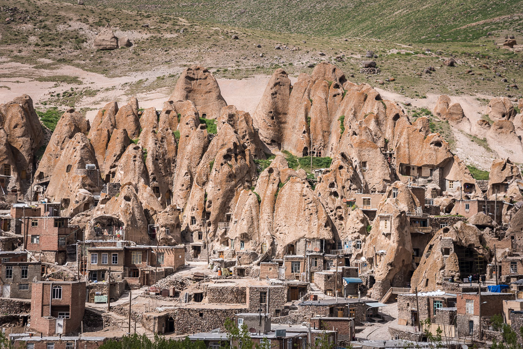
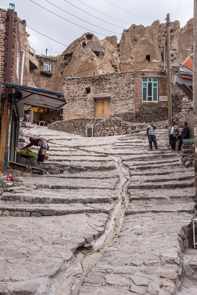
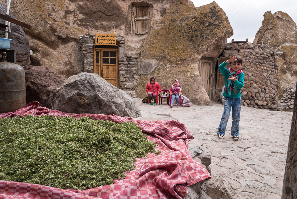
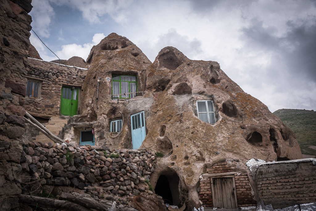
The village of Kandovan
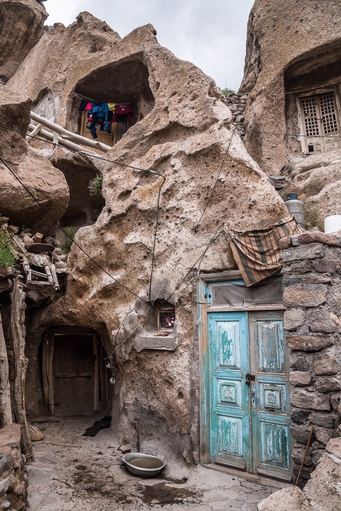
Welcome to the Flintstones 😉
Many homes have been partially transformed into a souvenir shop
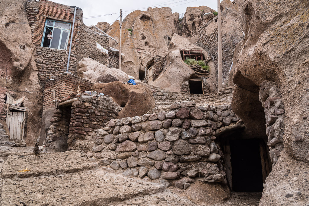
Livestock stays in the cellars of many houses at the night or during bad weather. On the way to the meadows, animals leave a thick trail of dung behind, which acts as reliable tourist repellent 😉
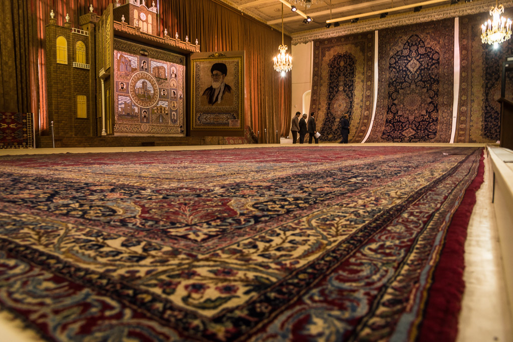
The museum of Tabriz is home to the biggest carpets I’ve ever seen

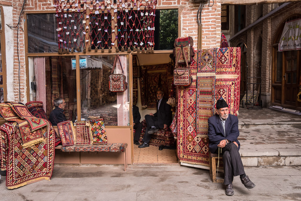
The UNESCO listed bazaar of Tabriz is said to be one of the largest and oldest covered bazaars in the world. Apart from those superlatives, it was definitely one of the most authentic bazaars I have come across, with a wide range of traditional goods, particularly carpets.

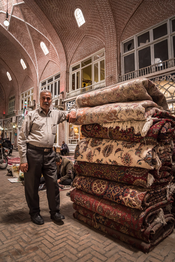
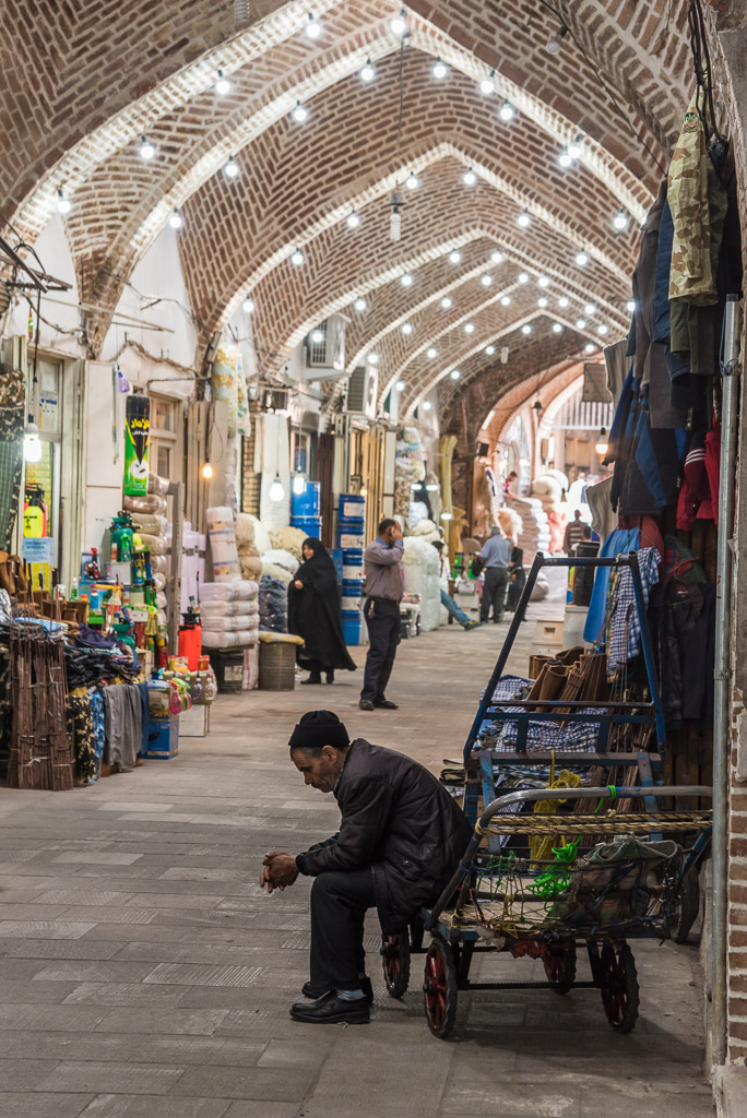
Almost all goods are carried by carts
From the outside the bazaar has a spaceship appearance
The Blue Mosque was severely damaged by an earthquake in 1780 and has been under construction since 1973
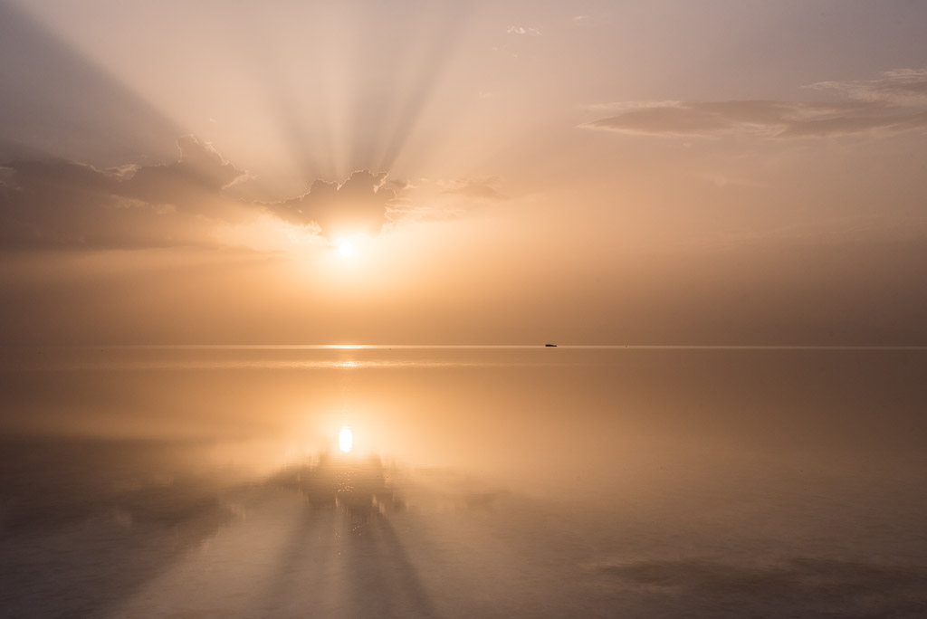
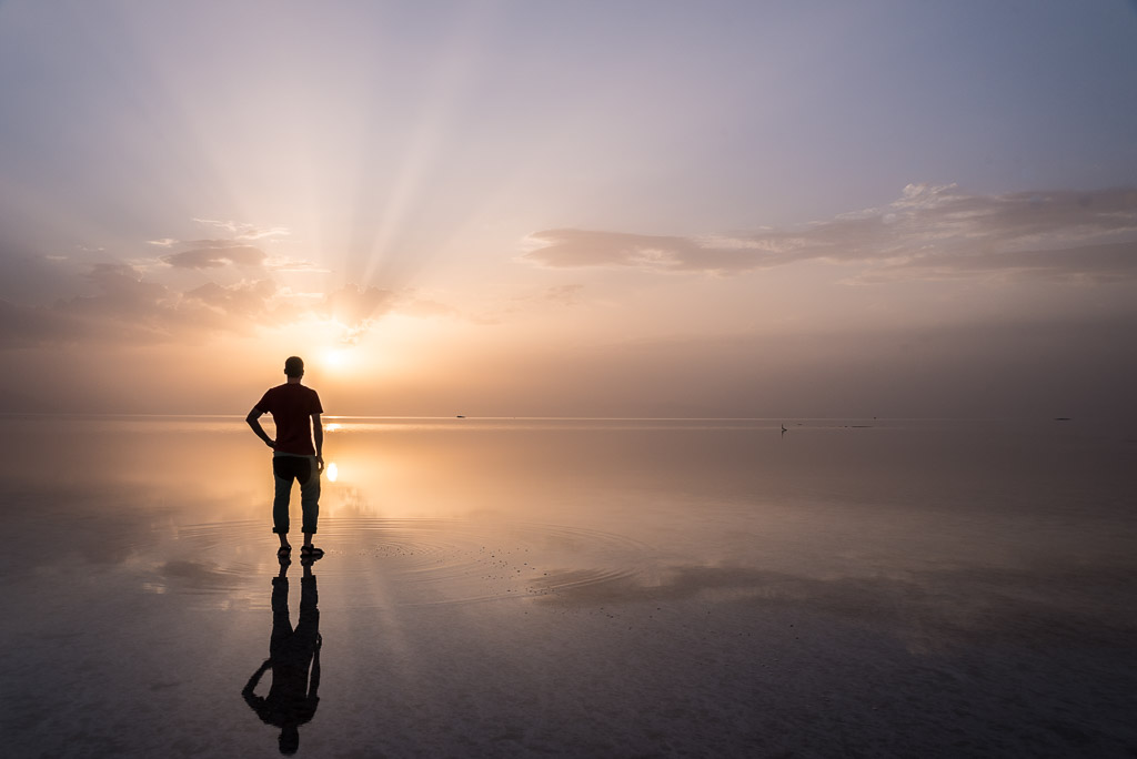
Sunset over lake Urmia
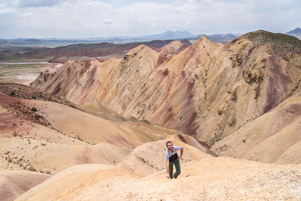
Unknown to guide books and tour companies, the colourful mountains near Tabriz are Mehdi’s insider tip
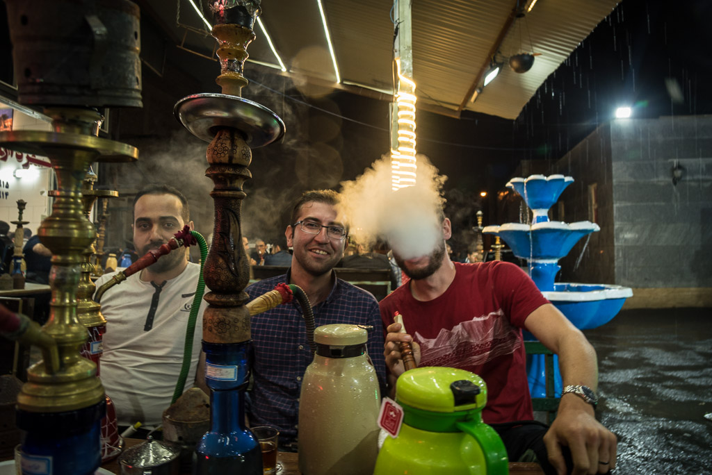
Mehdi’s favourite place for hanging out with friends.
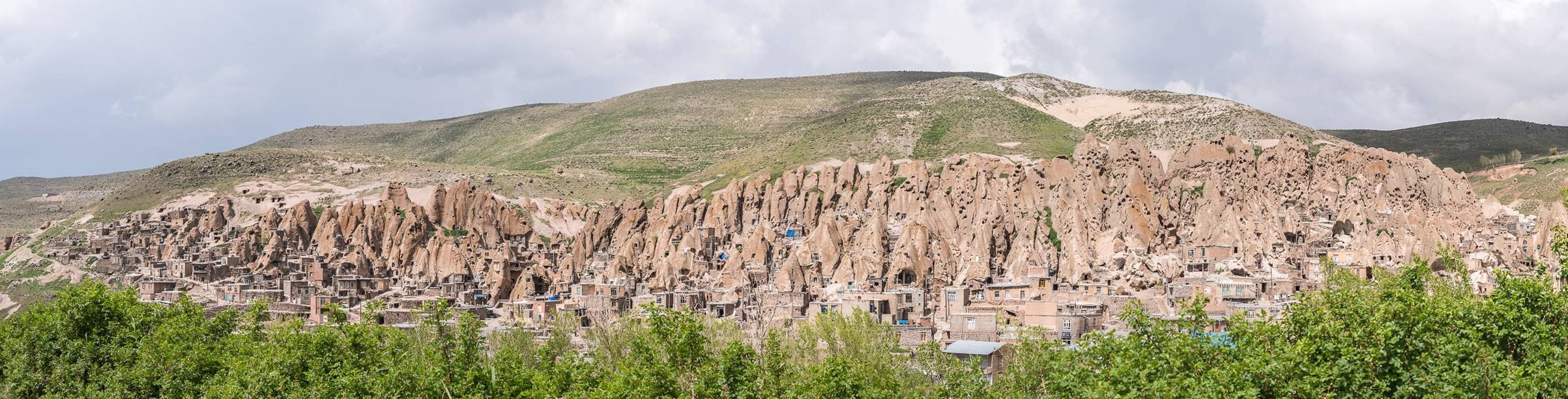
The panorama of Kandovan
Albertotsl
11. September 2020interessant, bitte erzähl mehr.
Steffen Markert
9. Dezember 2018Hello Thomas, my absolute favorite in this blog is Kandovan. I like this organic architecture, maybe Hundertwasser was there too. Hope to see you soon.